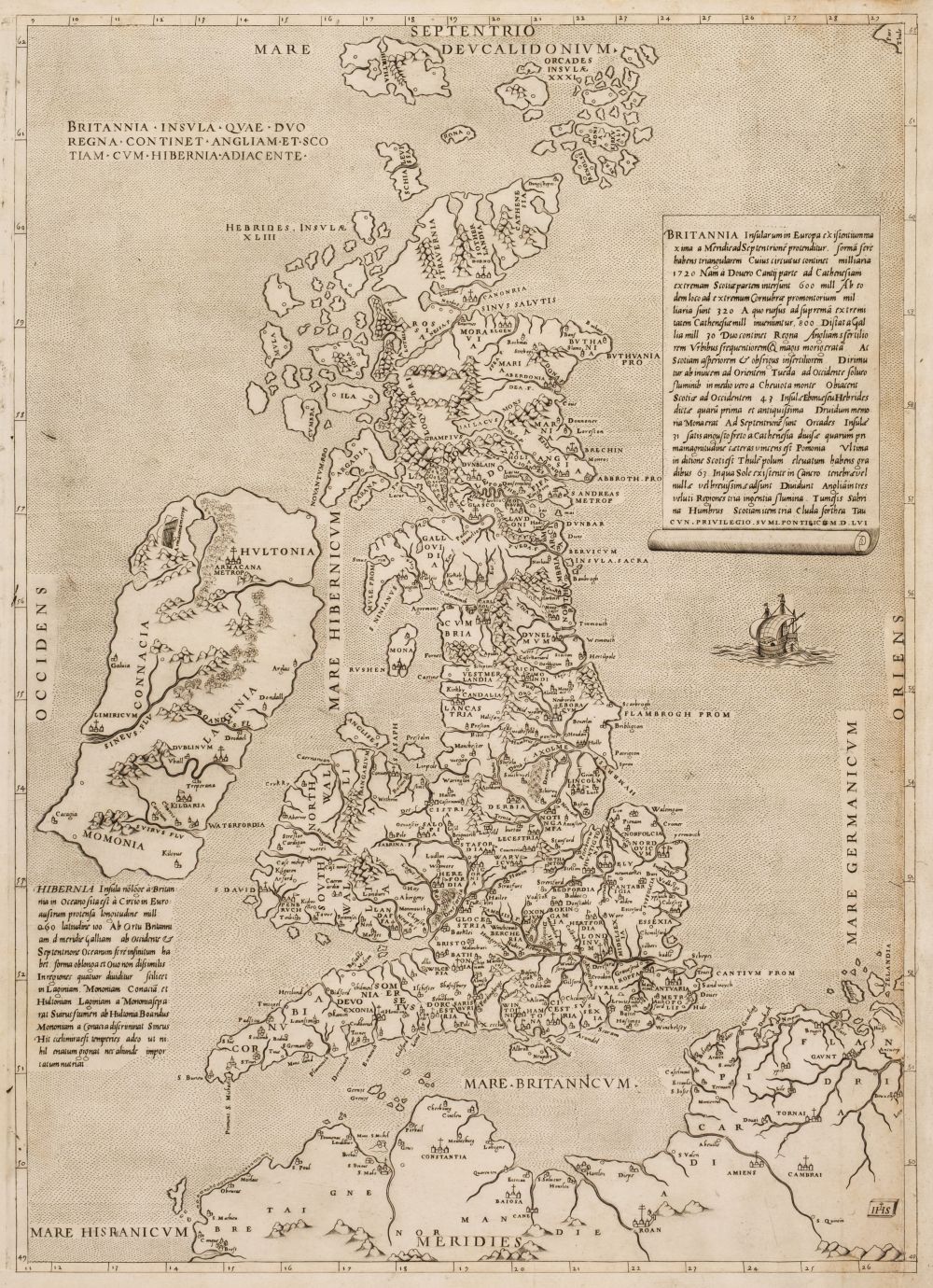
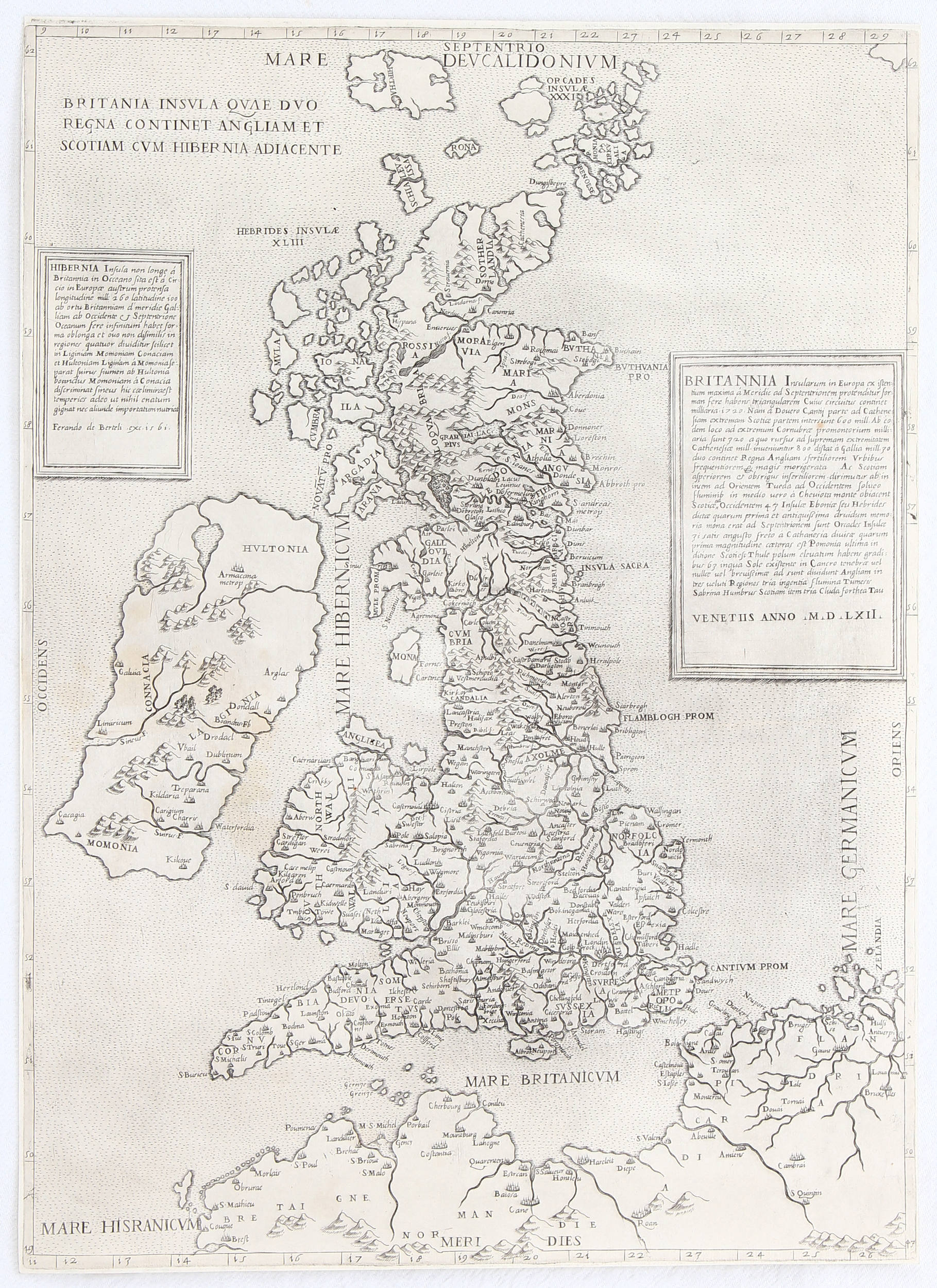
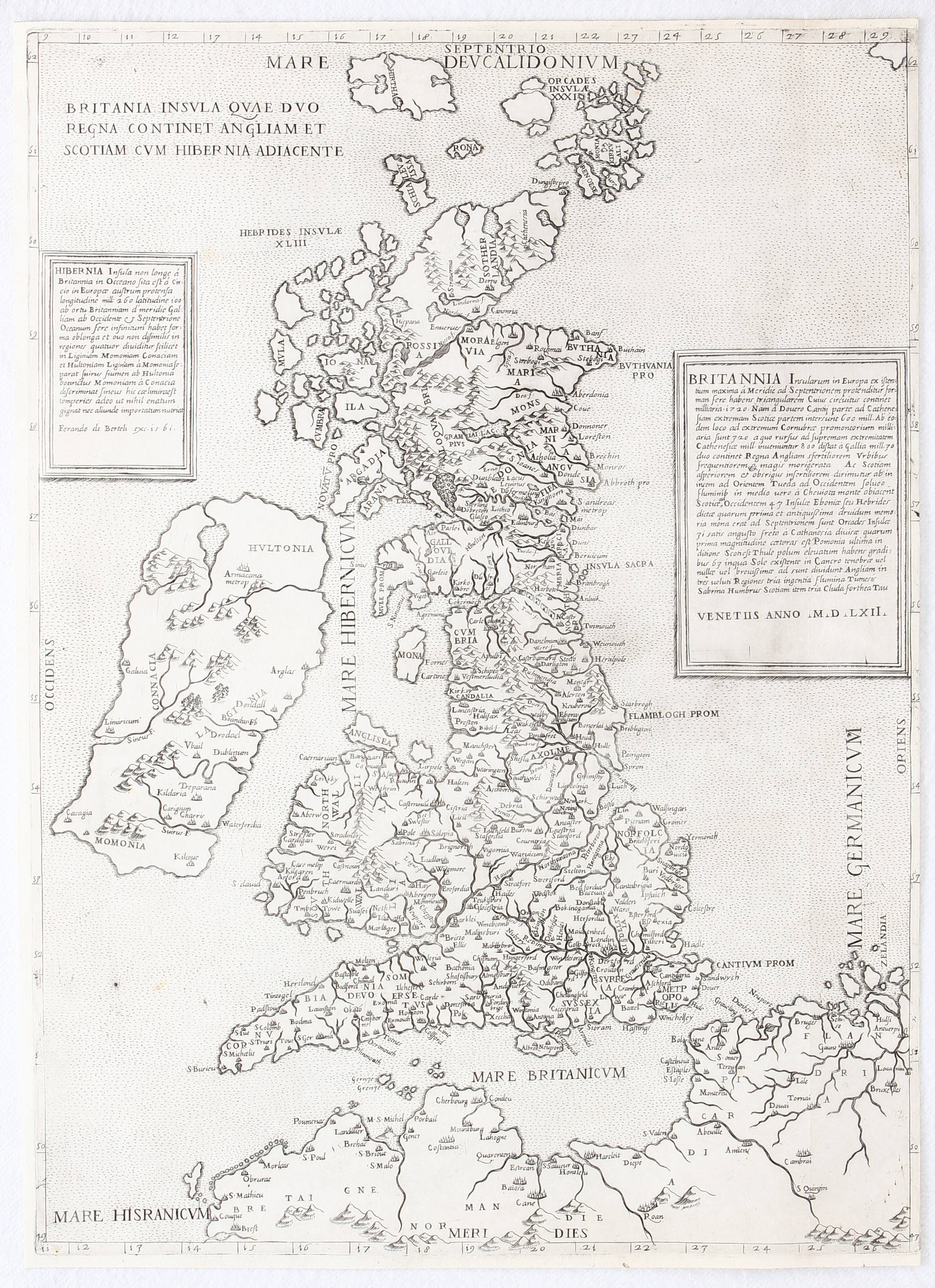
THE BRITISH ISLES - LILY, GEORGE ( fl. 1528-1559). Britanniae insulae quae nunc Angliae et Scotia regna continent cum Hibernia adiacente nova descriptio. Rome: George Lily, 1546. Engraved map of the British Isles, on two joined sheets, overall 556 x 758mm (Minor loss to upper central seam, tear at bottom centre, some discolouration to map throughout, very small hole at centre and upper centre.)
THE BRITISH ISLES - LILY, GEORGE ( fl. 1528-1559). Britanniae insulae quae nunc Angliae et Scotia regna continent cum Hibernia adiacente nova descriptio. Rome: George Lily, 1546. Engraved map of the British Isles, on two joined sheets, overall 556 x 758mm (Minor loss to upper central seam, tear at bottom centre, some discolouration to map throughout, very small hole at centre and upper centre.) A VERY RARE AND HIGHLY IMPORTANT MAP, THE EARLIEST SEPARATELY-PRINTED MAP TO SHOW THE BRITISH ISLES AS A WHOLE, here in the first state. This historic work was devised by George Lily, an English Catholic, who became "an editor of maps issued under the auspices of the Church" in Rome. The British Isles are shown resting on their side, oriented east-west. The shape of England and Wales is derived from Sebastian Munster's map of 1540 and perhaps the "Cotton Map", a manuscript produced c. 1535. A source for the depiction of Scotland may have been the map that John Elden presented to Henry VIII in 1538. Curiously, Ireland maintains the "potato shape", widely copied in subsequent maps. Shirley describes this masterpiece as "one of the finest engravings of the first part of the 16th century". While the artist who engraved the map is not known for certain, Shirley suggests that it was probably Nicolas Beatrizet Greatly influential, it was either directly copied or served as the prime influence for the most important maps of region printed in the succeeding decades. Karrow 33/3, Shirley:1991 no.41, Tooley:1939 no.268, watermark of a lozenge containing a star and surrounded by four stars in a circle, not in Woodward:1996.


.jpg)



Testen Sie LotSearch und seine Premium-Features 7 Tage - ohne Kosten!
Lassen Sie sich automatisch über neue Objekte in kommenden Auktionen benachrichtigen.
Suchauftrag anlegen