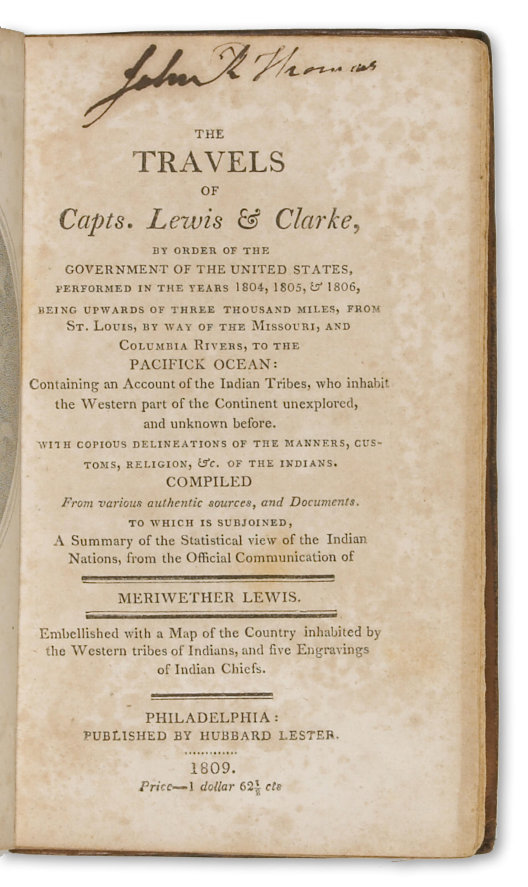
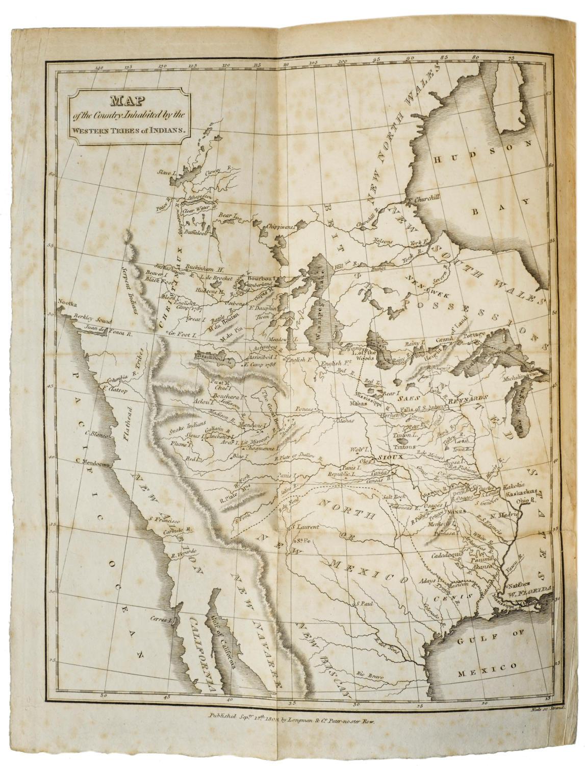
Title: The Travels of Capts. Lewis and Clarke, from St. Louis, by Way of the Missouri and Columbia Rivers, to the Pacific Ocean; Performed in the Years 1804, 1805, & 1806 by Order of the Government of the United States, Containing Delineations of the Manners, Customs, Religion, &c. of the Indians, compiled from Various Authentic Sources, and Original Documents, and a Summary of the Statistical View of the Indian Nations, from the Official Communication of Meriwether Lewis Author: ** Place: London Publisher: Longman, Hust, Rees & Orme Date: 1809 Description: ix, [1], 309 pp. With folding copper-engraved map. 8½x5, modern quarter leather and boards. First English Edition. The first English edition of the "apocryphal" Lewis and Clark, being little more that a compilation and rehashing of Jefferson's Message of 1806, Patrick Gass's Journal published in 1807, and plagiarizations of portions of Jonathan Carver and Alexander Mackenzie Despite its suspect origins, and the massive criticism it has received from scholars (Coues called it a "wretched meretricious compilation"), it is important in that it was for a time a major source of information on the Far West. The map, which is the same as the map published in the American edition of the same year (both had a Longman & Co. imprint, published Sept. 12th, 1809, engraved by Neele) is "Map of the Country Inhabited by the Western Tribes of Indians." It is the earliest published map with "legends stemming from Lewis and Clark... Here were the earliest published cartographic reflections of Lewis and Clark's great effort, and this fact alone distinguishes this small map, which otherwise harks back to earlier days." - Wheat, who lists Lester as the cartographer. Among the new features on the map is the presence of "F. Clatsop" at the mouth of the Columbia River. Field 928; Graff 2379; Howes L321; Sabin 40827; Smith 5894; Streeter Sale 3122; Wagner-Camp 8:2; Wheat Transmississippi 294. Lot Amendments Condition: Foxing to about a dozen leaves; very good or better, the map fine. Item number: 189991
Title: The Travels of Capts. Lewis and Clarke, from St. Louis, by Way of the Missouri and Columbia Rivers, to the Pacific Ocean; Performed in the Years 1804, 1805, & 1806 by Order of the Government of the United States, Containing Delineations of the Manners, Customs, Religion, &c. of the Indians, compiled from Various Authentic Sources, and Original Documents, and a Summary of the Statistical View of the Indian Nations, from the Official Communication of Meriwether Lewis Author: ** Place: London Publisher: Longman, Hust, Rees & Orme Date: 1809 Description: ix, [1], 309 pp. With folding copper-engraved map. 8½x5, modern quarter leather and boards. First English Edition. The first English edition of the "apocryphal" Lewis and Clark, being little more that a compilation and rehashing of Jefferson's Message of 1806, Patrick Gass's Journal published in 1807, and plagiarizations of portions of Jonathan Carver and Alexander Mackenzie Despite its suspect origins, and the massive criticism it has received from scholars (Coues called it a "wretched meretricious compilation"), it is important in that it was for a time a major source of information on the Far West. The map, which is the same as the map published in the American edition of the same year (both had a Longman & Co. imprint, published Sept. 12th, 1809, engraved by Neele) is "Map of the Country Inhabited by the Western Tribes of Indians." It is the earliest published map with "legends stemming from Lewis and Clark... Here were the earliest published cartographic reflections of Lewis and Clark's great effort, and this fact alone distinguishes this small map, which otherwise harks back to earlier days." - Wheat, who lists Lester as the cartographer. Among the new features on the map is the presence of "F. Clatsop" at the mouth of the Columbia River. Field 928; Graff 2379; Howes L321; Sabin 40827; Smith 5894; Streeter Sale 3122; Wagner-Camp 8:2; Wheat Transmississippi 294. Lot Amendments Condition: Foxing to about a dozen leaves; very good or better, the map fine. Item number: 189991


.jpg)


Testen Sie LotSearch und seine Premium-Features 7 Tage - ohne Kosten!
Lassen Sie sich automatisch über neue Objekte in kommenden Auktionen benachrichtigen.
Suchauftrag anlegen