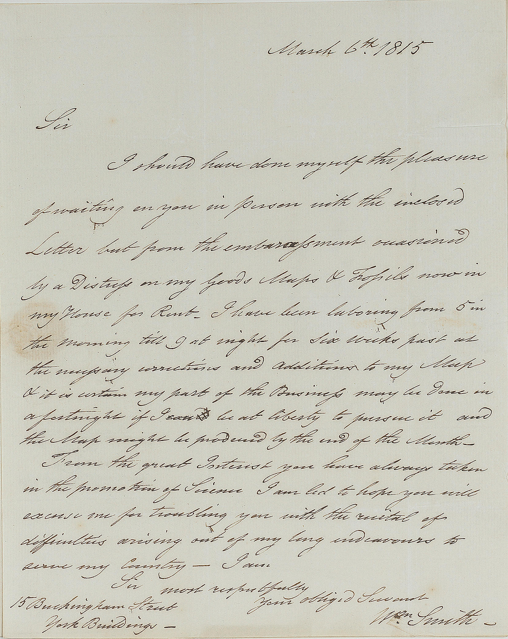
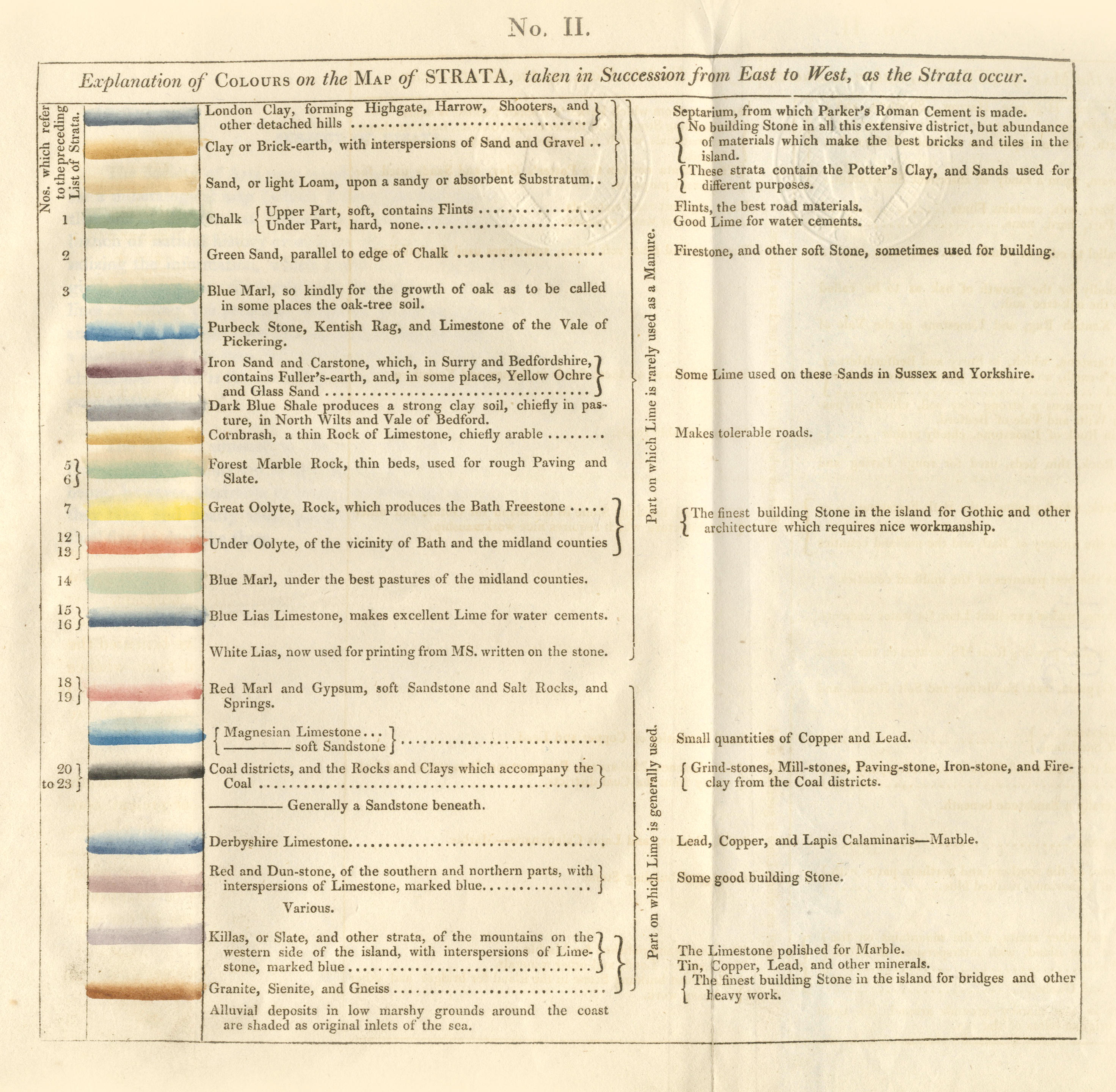
SMITH, William (1769-1830). A Delineation of the Strata of England and Wales, with part of Scotland . London: John Cary, 1 August, 1815 [but January 1816]. 'The map that changed the world' — the first printed large-scale geological map on a national scale. The present work is the triumphant culmination of Smith's recognition, and major contribution to the science of geology, that each individual stratum can be identified by its unique fossil record. It was this theory that enabled Smith to accurately predict, and therefore map, the varying geological outcrops throughout the country. Indeed, the accuracy of his great map is quite outstanding and modern versions have only relatively minor modifications. Based entirely on Smith's own discoveries, the map covers approximately 65,000 square miles and is a cartographical tour de force. The stratigraphical succession of 21 different sedimentary beds or groups of beds is indicated by different colours, with darkened edges showing superposition, and separate colours being used for large masses of granite or other crystalline rocks. Lead, tin, and copper mines, salt and alum works, collieries and canals are indicated by special symbols. Although Steno had previously noted the possibilities of dating strata through their fossil content, and although Smith himself drew no theoretical conclusions from his stratigraphical discoveries, which he viewed exclusively as a tool for economic development, his work, which established some of the most familiar names in geographical nomenclature, proved that palaeontology is a fundamental part of geology. In doing so it convinced contemporary geologists that the strata in all parts of the earth's crust belong to a single chronological sequence, a fundamental step in the development of evolutionary theory. Most probably no more than 320-350 copies of the map were published, of which perhaps 130 survive today. Smith continued making small revisions and alterations to his map, and five consecutive series of it have been distinguished by Joan M. Eyles, 'William Smith... a bibliography,' in J. Soc. Biblphy nat. Hist. (1969) 5 (2): 87-109 (her no. 12). The present lot corresponds to Eyles' second issue, series III map; series I was restricted to 20 unnumbered maps, while series II and III were numbered 1-100 and a1-a100 respectively. The present map, a65, was examined and signed by Smith on 13 January 1816. It was one of a batch of 15, which had been coloured by Morse, signed that day and numbered. Challinor 76; Grolier/Horblit 94; PMM 274; Tooley, Maps and Mapmakers , p.58; Tooley, Dictionary of Mapmakers , p.181; Winchester (London, 2001). A fine, fresh copy. Large hand-coloured engraved wall map drawn on a scale of 5 miles to one inch, dissected and mounted on linen, and folded into 3 separate sections, the 'North Part' and 'South Part' with printed paper labels (North and Centre 1838 x 1080mm, South 1838 x 540mm). An elaborate map of the geological strata, engraved title top right, key, scale-bar and 'Sketch of the Succession of the Strata', signed and numbered 'a 65' in ink manuscript by Smith (faint areas of light surface soiling). Original paper-covered slipcase (rubbed and scuffed).
SMITH, William (1769-1830). A Delineation of the Strata of England and Wales, with part of Scotland . London: John Cary, 1 August, 1815 [but January 1816]. 'The map that changed the world' — the first printed large-scale geological map on a national scale. The present work is the triumphant culmination of Smith's recognition, and major contribution to the science of geology, that each individual stratum can be identified by its unique fossil record. It was this theory that enabled Smith to accurately predict, and therefore map, the varying geological outcrops throughout the country. Indeed, the accuracy of his great map is quite outstanding and modern versions have only relatively minor modifications. Based entirely on Smith's own discoveries, the map covers approximately 65,000 square miles and is a cartographical tour de force. The stratigraphical succession of 21 different sedimentary beds or groups of beds is indicated by different colours, with darkened edges showing superposition, and separate colours being used for large masses of granite or other crystalline rocks. Lead, tin, and copper mines, salt and alum works, collieries and canals are indicated by special symbols. Although Steno had previously noted the possibilities of dating strata through their fossil content, and although Smith himself drew no theoretical conclusions from his stratigraphical discoveries, which he viewed exclusively as a tool for economic development, his work, which established some of the most familiar names in geographical nomenclature, proved that palaeontology is a fundamental part of geology. In doing so it convinced contemporary geologists that the strata in all parts of the earth's crust belong to a single chronological sequence, a fundamental step in the development of evolutionary theory. Most probably no more than 320-350 copies of the map were published, of which perhaps 130 survive today. Smith continued making small revisions and alterations to his map, and five consecutive series of it have been distinguished by Joan M. Eyles, 'William Smith... a bibliography,' in J. Soc. Biblphy nat. Hist. (1969) 5 (2): 87-109 (her no. 12). The present lot corresponds to Eyles' second issue, series III map; series I was restricted to 20 unnumbered maps, while series II and III were numbered 1-100 and a1-a100 respectively. The present map, a65, was examined and signed by Smith on 13 January 1816. It was one of a batch of 15, which had been coloured by Morse, signed that day and numbered. Challinor 76; Grolier/Horblit 94; PMM 274; Tooley, Maps and Mapmakers , p.58; Tooley, Dictionary of Mapmakers , p.181; Winchester (London, 2001). A fine, fresh copy. Large hand-coloured engraved wall map drawn on a scale of 5 miles to one inch, dissected and mounted on linen, and folded into 3 separate sections, the 'North Part' and 'South Part' with printed paper labels (North and Centre 1838 x 1080mm, South 1838 x 540mm). An elaborate map of the geological strata, engraved title top right, key, scale-bar and 'Sketch of the Succession of the Strata', signed and numbered 'a 65' in ink manuscript by Smith (faint areas of light surface soiling). Original paper-covered slipcase (rubbed and scuffed).


Testen Sie LotSearch und seine Premium-Features 7 Tage - ohne Kosten!
Lassen Sie sich automatisch über neue Objekte in kommenden Auktionen benachrichtigen.
Suchauftrag anlegen