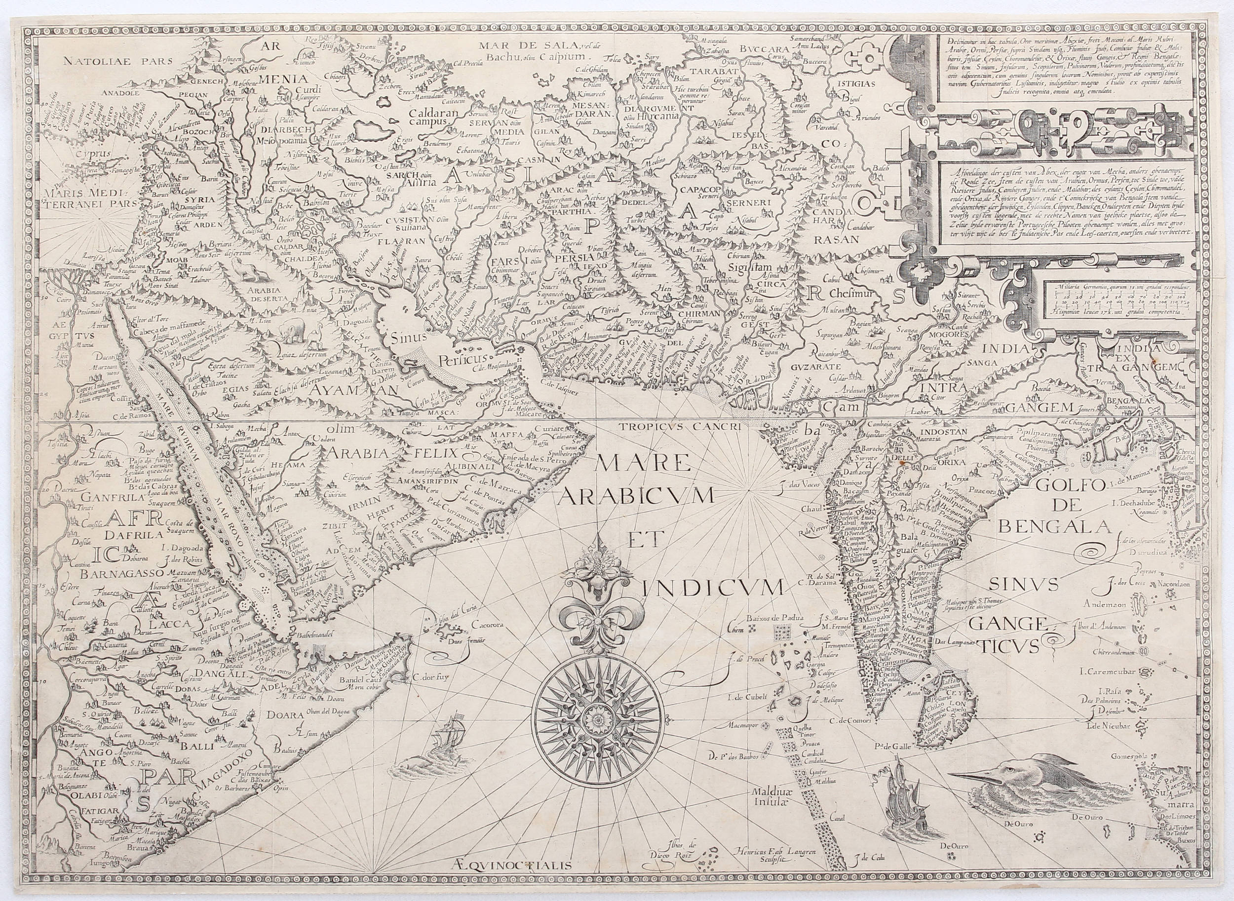
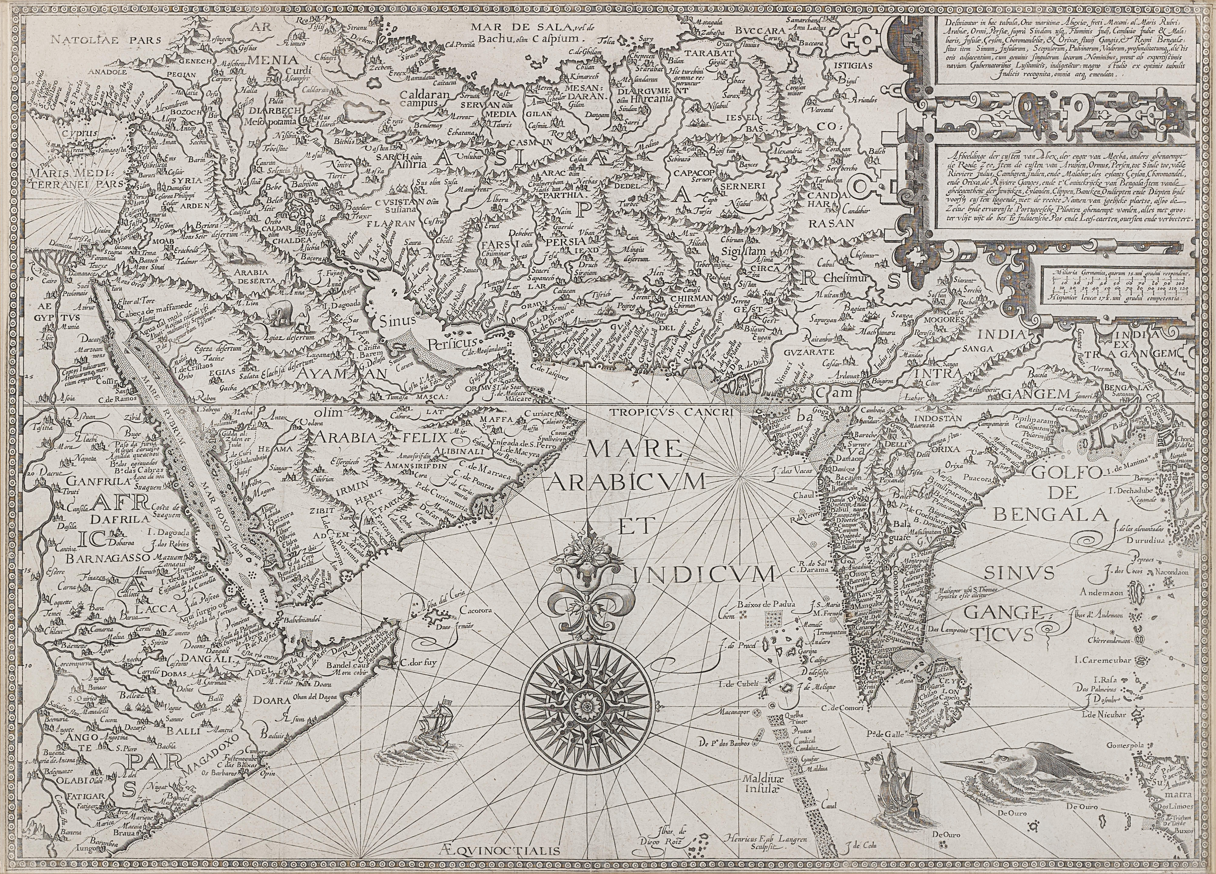
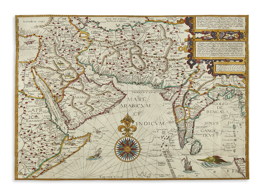
Title: Deliniantur in hac Tabula, Orae Maritimae Abexiae, Freti Mecani; al Maris Rubri; Arabiae, Ormi, Persiae, Supra Sindam usq, Fluminis Indi, Cambriae India & Malabaris, Insulae, Ceylon... Author: Linschoten, Jan Huygen van Place: [Amsterdam] Publisher: Date: [1596] Description: Copper-engraved map. 38.5x53 cm (15¼x20¾"), archivally matted & framed under UV protective glass. Important and quite decorative map of southern Asia, from the Arabian peninsula to the mouth of the Ganges, with all of India, Ceylon, the Horn of Africa, and north to the Caspian Sea, with Cyprus and the Holy Land in the west. It is considered one of the first detailed navigational charts of the Indian Ocean and Arabian Sea. The map was issued in van Linschoten's "Itinerario, Voyage ofte Schipvaert naer Oost ofte Portugaels Indien..." Although partially based on Giacomo Gastaldi's map for the interior regions, the engraver Henricus Langren also used portolan charts to refine coastal detail. In addition, the Indian subcontinent was based on Linschoten's experience living in India for thirteen years, resulting in a much more accurate shape than shown on previous maps by Ortelius and Mercator. The Arabian peninsula is also depicted more accurately than previously, although there is little interior detail. This map is believed to be the first to use the names Babelmandel (now Bab el-Mandeb) for the strait at the southern tip of the Red Sea and Mare Arabicum for the Arabian Sea. The map is adorned with a large compass rose, sea monsters, sailing vessels, and a number of animals, including a pair of unicorns in the interior of India. Tibbetts #46. Handsomely framed by Schein & Schein, San Francisco. Provenance: Barbara Keck. Due to the size and/or weight of this lot extra shipping charges may apply. Lot Amendments Condition: Perhaps a touch of faint dust soiling and surface wear to the paper; fine condition Item number: 277196
Title: Deliniantur in hac Tabula, Orae Maritimae Abexiae, Freti Mecani; al Maris Rubri; Arabiae, Ormi, Persiae, Supra Sindam usq, Fluminis Indi, Cambriae India & Malabaris, Insulae, Ceylon... Author: Linschoten, Jan Huygen van Place: [Amsterdam] Publisher: Date: [1596] Description: Copper-engraved map. 38.5x53 cm (15¼x20¾"), archivally matted & framed under UV protective glass. Important and quite decorative map of southern Asia, from the Arabian peninsula to the mouth of the Ganges, with all of India, Ceylon, the Horn of Africa, and north to the Caspian Sea, with Cyprus and the Holy Land in the west. It is considered one of the first detailed navigational charts of the Indian Ocean and Arabian Sea. The map was issued in van Linschoten's "Itinerario, Voyage ofte Schipvaert naer Oost ofte Portugaels Indien..." Although partially based on Giacomo Gastaldi's map for the interior regions, the engraver Henricus Langren also used portolan charts to refine coastal detail. In addition, the Indian subcontinent was based on Linschoten's experience living in India for thirteen years, resulting in a much more accurate shape than shown on previous maps by Ortelius and Mercator. The Arabian peninsula is also depicted more accurately than previously, although there is little interior detail. This map is believed to be the first to use the names Babelmandel (now Bab el-Mandeb) for the strait at the southern tip of the Red Sea and Mare Arabicum for the Arabian Sea. The map is adorned with a large compass rose, sea monsters, sailing vessels, and a number of animals, including a pair of unicorns in the interior of India. Tibbetts #46. Handsomely framed by Schein & Schein, San Francisco. Provenance: Barbara Keck. Due to the size and/or weight of this lot extra shipping charges may apply. Lot Amendments Condition: Perhaps a touch of faint dust soiling and surface wear to the paper; fine condition Item number: 277196


Testen Sie LotSearch und seine Premium-Features 7 Tage - ohne Kosten!
Lassen Sie sich automatisch über neue Objekte in kommenden Auktionen benachrichtigen.
Suchauftrag anlegen