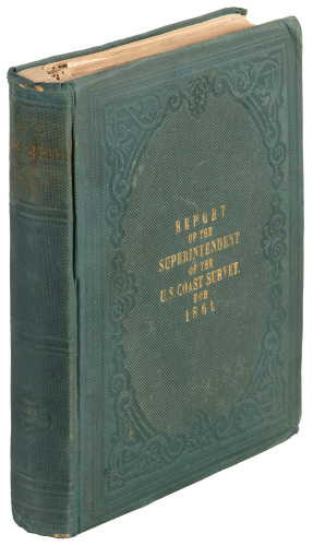
Title: Report of the Superintendent of the United States Coast Survey, Showing the Progress of the Survey During the Fiscal Year Ending With June, 1880 Author: ** Place: Washington Publisher: Government Printing Office Date: 1882 Description: xxii, 419 pp. 88 maps, charts, etc. most folding. (4to) 11¼x9, original black cloth. First Edition. Several notable articles in this annual report includes: On the Determination of time, longitude, latitude, and azimuth; Report of the Temperature and Currents of the Bering Sea and the adjacent waters; An Attempt to Solve the Problem of the first landing place of Columbus in the New World; An inquiry in the variation of the compass off the Bahama Islands at the time of the landing of Columbus in 1492. Includes a chart showing the track of the 1492 Voyage of Columbus. Lot Amendments Condition: Binding shaken, shelf wear; good. Item number: 201963
Title: Report of the Superintendent of the United States Coast Survey, Showing the Progress of the Survey During the Fiscal Year Ending With June, 1880 Author: ** Place: Washington Publisher: Government Printing Office Date: 1882 Description: xxii, 419 pp. 88 maps, charts, etc. most folding. (4to) 11¼x9, original black cloth. First Edition. Several notable articles in this annual report includes: On the Determination of time, longitude, latitude, and azimuth; Report of the Temperature and Currents of the Bering Sea and the adjacent waters; An Attempt to Solve the Problem of the first landing place of Columbus in the New World; An inquiry in the variation of the compass off the Bahama Islands at the time of the landing of Columbus in 1492. Includes a chart showing the track of the 1492 Voyage of Columbus. Lot Amendments Condition: Binding shaken, shelf wear; good. Item number: 201963


Testen Sie LotSearch und seine Premium-Features 7 Tage - ohne Kosten!
Lassen Sie sich automatisch über neue Objekte in kommenden Auktionen benachrichtigen.
Suchauftrag anlegen