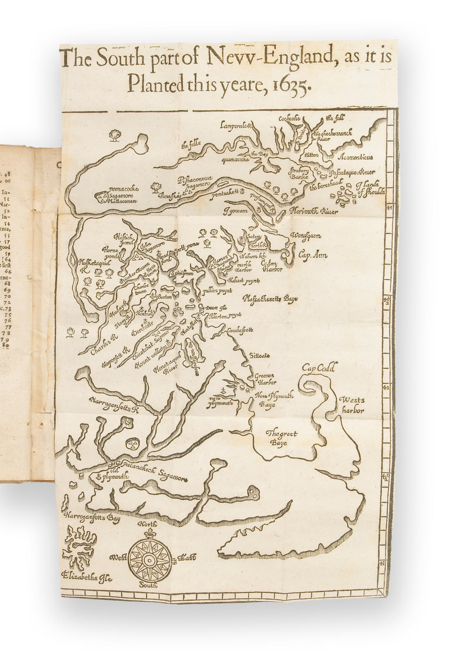
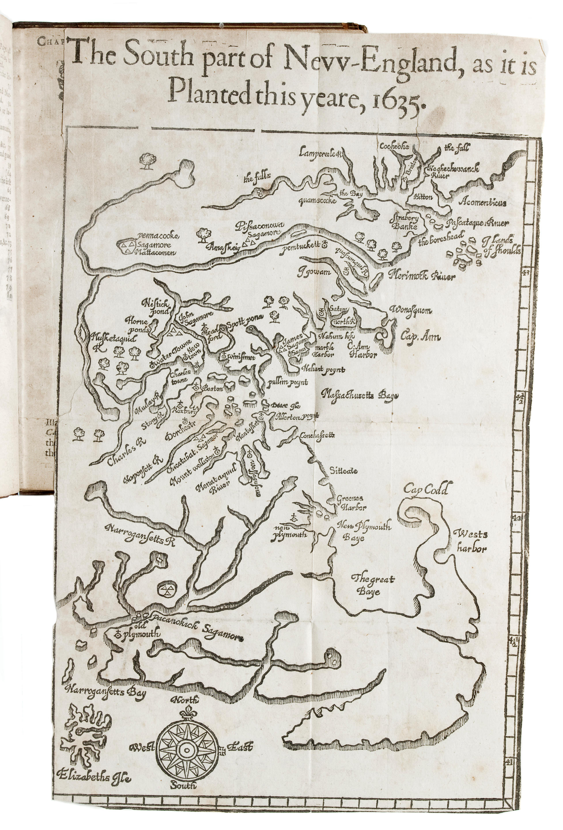
WOOD, William (1580-1639). New England's Prospect, A true, lively and experimentall description of that part of America, commonly called New England: discovering the state of that Country, both as it stands to our new-come Planters; and to the old Native Inhabitants . London: John Dawson for John Bellamy, 1639.
WOOD, William (1580-1639). New England's Prospect, A true, lively and experimentall description of that part of America, commonly called New England: discovering the state of that Country, both as it stands to our new-come Planters; and to the old Native Inhabitants . London: John Dawson for John Bellamy, 1639. 4° (169 x 128 mm. Folding woodcut map (332 x 196 mm sheet) entitled "The South Part of New-England, as it is Planted this yeare, 1639," lower and right deckle edges preserved (left edge of map shaved.) (First gathering with gutter margins repaired, and possibly supplied, outer margin of final leaf supplied in facsimile, closely trimmed throughout with some loss of text.) Early 20th-century brown levant morocco gilt, by F. Bedford (some light rubbing to extremities); brown quarter morocco slipcase. Provenance : Frank. C. Deering (bookplate). Third edition of this popular and extremely important description of the Massachusetts-Bay settlements, WITH THE WOODCUT MAP, THE FIRST BY A RESIDENT OF THE COLONIES, including Boston (founded 1630), Medford, Scituate, Nantasket, Marblehead, Dorchester, Roxbury, Medford, Watertown, New and Old Plymouth, and several interior Indian settlements ("Pemmacooke, Amaskeig" and "Mettacommen"). Wood spent some four years in Massachusetts, and based on his own first-hand knowledge, provides a remarkably detailed description of the topography of New England as then known. In Part 1 he writes of the climate "with the suitableness of it, to English bodies for health and sicknesse," gives advice for those thinking of undertaking the hazardous Atlantic crossing, and includes chapters describing a range of native trees, plants, fish, game and mineral ores. Part 2 of his account contains 20 chapters entirely devoted to the native inhabitants, the "Mowhawks," "Connectecuts," "Pequants and Narragansetts": their apparel, wars, games and sports, hunting and fishing, arts and language. On five pages at the end Wood offers one of the earliest grammars of the Massachusetts Indians (265 terms in the first edition, here expanded), in the compilation of which he may have been assisted by Roger Williams and perhaps John Eliot. The woodcut map is more detailed than any previous maps of the region, and depicts the complex topography of the coast from the Penobscot River and Mount Desert Island (here named "Hitton"), south to the Merrimack River, Massachusetts Bay, Cape Cod and Narragansett Bay. Church 444; JCB II, p.279; Pilling Algonquian , pp. 535-536; Sabin 105076; Schwartz & Ehrenberg, pl.55 ("First map of the region, by a resident"); STC 25959.


Testen Sie LotSearch und seine Premium-Features 7 Tage - ohne Kosten!
Lassen Sie sich automatisch über neue Objekte in kommenden Auktionen benachrichtigen.
Suchauftrag anlegen