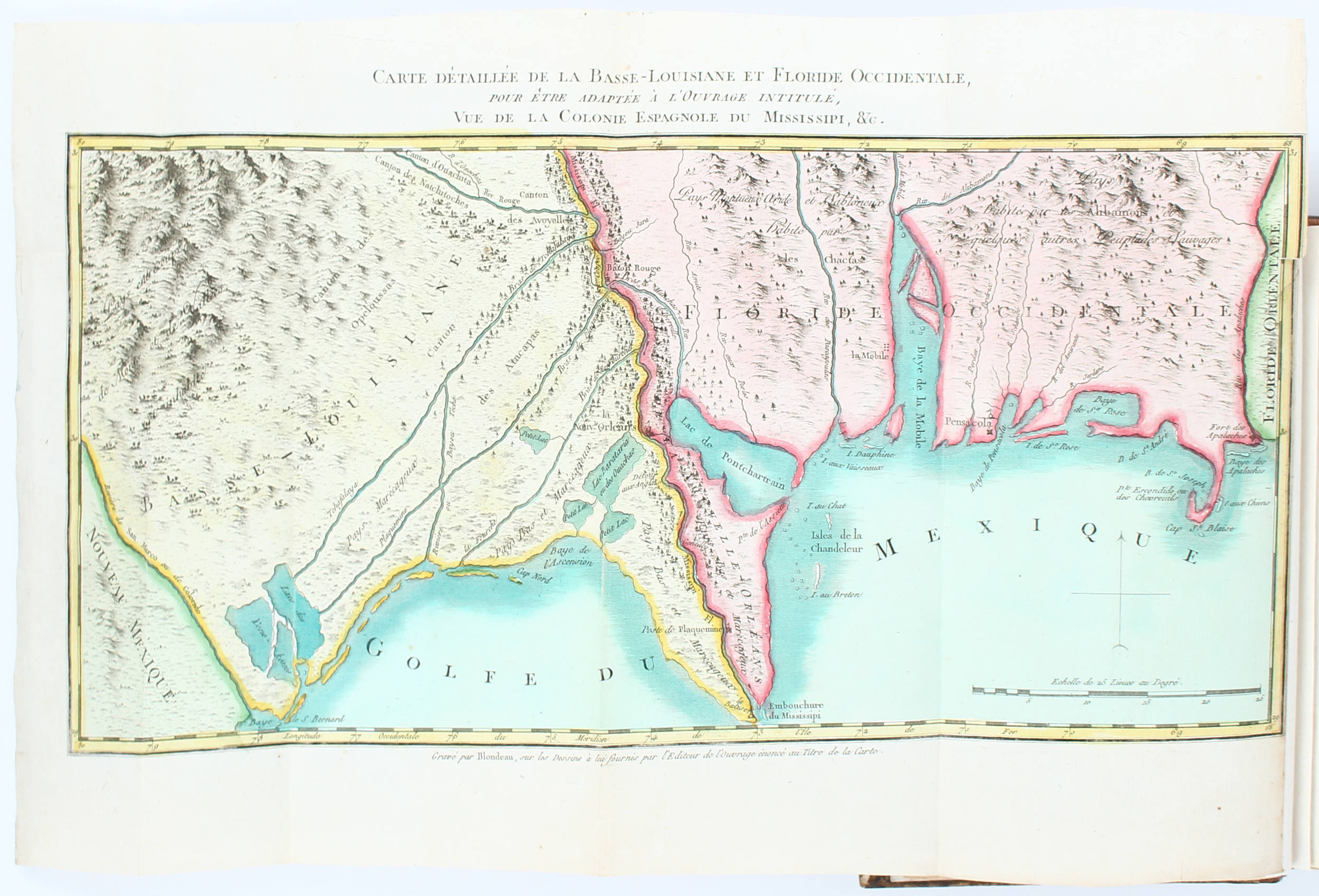
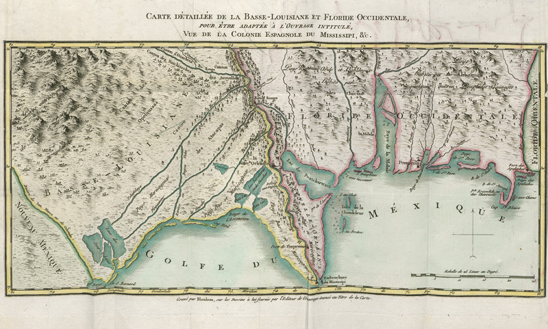
Title: Vue de la Colonie Espagnole du Mississipi, ou des Provinces de Louisiane et Floride Occidentale, en l’Annee 1802, par un Observateur Resident sur les Lieux… Author: [Berquin-Duvallon] Place: Paris Publisher: A l’Imprimerie Expeditive Date: 1803 Description: xx, 318, [5], [1] pp. Two folding hand-colored maps. (8vo) 7½x4½, modern three-quarter brown morocco and marbled boards, spine gilt, all edges red. First Edition. “This gives an entertaining and gossipy first-hand picture of life in New Orleans at the turn of the century; its theatrical companies, dances, the high status of medical doctors, gaucheries of the Creoles, and so on. At the end there are general accounts of the natural features of Louisiana, its commerce, and other general subjects. Its two colored maps, one of lower, the other of upper Louisiana to the Falls of St. Anthony are well worth while.” – Streeter. Little is known of the author of this work save that he was born in Santo-Domingo, where he was procureur du roi before the slave uprising. Berquin-Duvallon apparently fled to Baltimore, whose hospitality to the French refugees and their slaves he praised. Louisiana, on the other hand, afraid of revolutionary blacks prohibited the immigration of the latter, the author violated this law and found himself in trouble. Perhaps for this reason his picture of Spanish Louisiana is not a particularly pretty one. The colored maps, engraved by Blondeau, are titled: Carte Detaillee de la Basse-Louisiana et Floride Occidentale… and Carte Reduite de la Haute-Louisiane et Pays Circonvoisins…depict, respectively, much of Texas, a portion of Mexico labeled “Nouveau Mexique,” the Louisiana coastal area to West Florida, and Louisiana Territory north to the Great Lakes, and the “vastes contrees peu connues.” Clark I, 79; Howes B-389; Sabin 4962; Streeter Sale 1530. Lot Amendments Condition: Text has been washed, and paper resized, some faint old damp-staining, small paper repair to portion of title-page, with loss of a few letters of text, else a very good clean copy in a fine modern binding. Item number: 193554
Title: Vue de la Colonie Espagnole du Mississipi, ou des Provinces de Louisiane et Floride Occidentale, en l’Annee 1802, par un Observateur Resident sur les Lieux… Author: [Berquin-Duvallon] Place: Paris Publisher: A l’Imprimerie Expeditive Date: 1803 Description: xx, 318, [5], [1] pp. Two folding hand-colored maps. (8vo) 7½x4½, modern three-quarter brown morocco and marbled boards, spine gilt, all edges red. First Edition. “This gives an entertaining and gossipy first-hand picture of life in New Orleans at the turn of the century; its theatrical companies, dances, the high status of medical doctors, gaucheries of the Creoles, and so on. At the end there are general accounts of the natural features of Louisiana, its commerce, and other general subjects. Its two colored maps, one of lower, the other of upper Louisiana to the Falls of St. Anthony are well worth while.” – Streeter. Little is known of the author of this work save that he was born in Santo-Domingo, where he was procureur du roi before the slave uprising. Berquin-Duvallon apparently fled to Baltimore, whose hospitality to the French refugees and their slaves he praised. Louisiana, on the other hand, afraid of revolutionary blacks prohibited the immigration of the latter, the author violated this law and found himself in trouble. Perhaps for this reason his picture of Spanish Louisiana is not a particularly pretty one. The colored maps, engraved by Blondeau, are titled: Carte Detaillee de la Basse-Louisiana et Floride Occidentale… and Carte Reduite de la Haute-Louisiane et Pays Circonvoisins…depict, respectively, much of Texas, a portion of Mexico labeled “Nouveau Mexique,” the Louisiana coastal area to West Florida, and Louisiana Territory north to the Great Lakes, and the “vastes contrees peu connues.” Clark I, 79; Howes B-389; Sabin 4962; Streeter Sale 1530. Lot Amendments Condition: Text has been washed, and paper resized, some faint old damp-staining, small paper repair to portion of title-page, with loss of a few letters of text, else a very good clean copy in a fine modern binding. Item number: 193554




Testen Sie LotSearch und seine Premium-Features 7 Tage - ohne Kosten!
Lassen Sie sich automatisch über neue Objekte in kommenden Auktionen benachrichtigen.
Suchauftrag anlegen