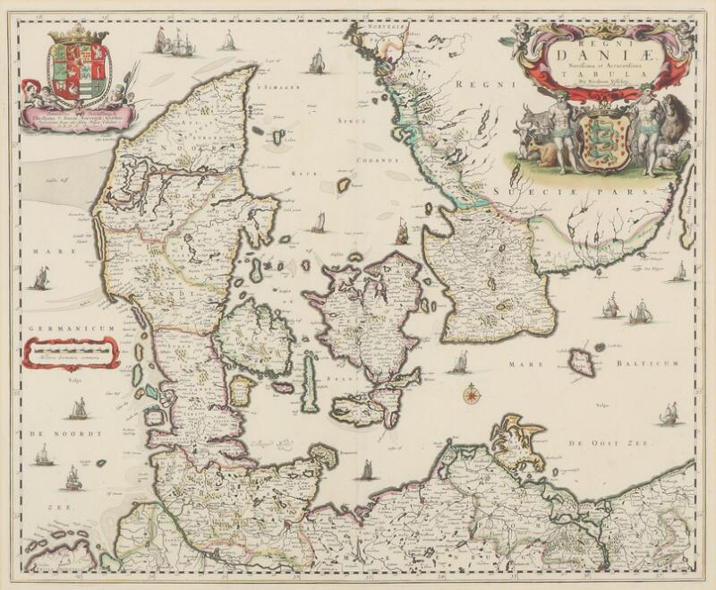
VISSCHER, NICOLAES II (1649-1702) [and others]. Atlas minor, sive geographia compendiosa qua orbis terrarum per paucas attamen novissimas tabulas ostenditura . Amsterdam: Nicolaes Visscher, [1696 or later]. 2 volumes, 2° (532 x 335 mm). Mounted on guards throughout. 6 engraved titles, including a general title by Gerard de Lairesse and 5 allegorical regional engraved titles, for the Low Countries ( Germaniae inferior ), by Lairesse, Europe, Asia, Africa, and America, these four from Blaeu's Atlas Major , the first 3 unsigned, the America title signed by the engraver T. Falck, 186 FULL-SHEET OR FOLDING ENGRAVED MAPS OF ALL PARTS OF THE WORLD BY NICOLAES VISSCHER AND OTHER MOSTLY DUTCH MAPMAKERS, MAPS AND TITLES FINELY COLORED BY A CONTEMPORARY HAND, the maps colored in outline with cartouches, decorative borders, embellishments, and landmarks fully colored, most undated, three maps dated 1696, two dated 1694 and one dated 1656, most double-page, 13 folding (1 1/2 sheets and smaller), the maps variously numbered in ink at upper left, lower or upper right, and/or on versos (the two volumes separately numbered). Loosely inserted is a full-sheet view-plan of Purmer by I. Leupenius (uncolored). (Map 31 [Drachenberg] with two 4-inch tears scotch-taped on verso, 9 maps with small internal tears or repairs, mainly at fold junctures, about 35 maps with minor wear at center folds or slight fold separations, map 69 [Ducatus Geldriae] with 4-inch fold break, about 20 maps with very small slight abraded spots, mostly at lower gutter, 3 maps with tiny holes from acidic green pigment, soft creases to about 10 maps, very occasional minor marginal tears or fraying, map 181 [Visscher, West Indies] slightly browned). Publisher's blind-stamped dark brown goatskin over pasteboard (rebacked, restoration to corners and board edges, some rubbing). Provenance : Henry Grier Bryant (1859-1932), explorer and geographer, president and benefactor of the Geographical Society of Philadelphia, bookplate. A fine composite atlas, belonging to the series of large atlases compiled and sold by the Visscher family of art dealers and cartographers at the end of the seventeenth and early eighteenth centuries. No two of the Visscher atlases seem to have been identical in content, and most contain, like this one, a selection of maps by the Visschers themselves as well as other cartographers. The present particularly extensive atlas, issued without the usual printed or manuscript index, was probably assembled and colored to order for a German or Dutch customer, the first volume being almost entirely devoted to Northern European maps. The general contents are as follows: 1 celestial map by Ludovico Vlasblom after Johannes van Keulen, 3 world maps, consisting of two double-hemisphere maps, by Visscher (Shirley 406) and Carel Allard (Shirley 578), and Jacob Robyn's single hemisphere map on a projection centered on the North Pole (Shirley 582); one map each of the North Pole (Jansson) and South Pole (unsigned, probably Jansson-Mercator); 160 European maps including Scandinavia (12), Germany, including present-day Austria and Switzerland (43), Low Countries (48), Britain (7), France (21), Spain and Portugal (5), Italy (12), Malta (1), and Eastern Europe (i.e, Russia, Livonia, Poland, Prussia, Hungary and Greece, 11); 6 maps of Asia, 4 of Africa, and 10 maps of the Americas. 108 maps are by Nicolaes Visscher; the remainder are by Frederick de Wit (44), Hubert Jaillot (8), Carel Allard (7), Joan or J. and Cornelis Blaeu (6), Jan Jansson (2 or 3, see above), Gerard Valck (2), and one each by J. Robyn, Johannes van Keulen, J. Danckert, J. C. Berger, C. Specht, J. van Loon and Johannes de Ram plus an unsigned and unidentified map of the Cape of Good Hope. The American maps consist of a general map of North and South America by Allard, Jaillot's individual maps of North America and South America (both dated 1694), Blaeu's map of Brazil, and 7 maps by Visscher, showing the no
VISSCHER, NICOLAES II (1649-1702) [and others]. Atlas minor, sive geographia compendiosa qua orbis terrarum per paucas attamen novissimas tabulas ostenditura . Amsterdam: Nicolaes Visscher, [1696 or later]. 2 volumes, 2° (532 x 335 mm). Mounted on guards throughout. 6 engraved titles, including a general title by Gerard de Lairesse and 5 allegorical regional engraved titles, for the Low Countries ( Germaniae inferior ), by Lairesse, Europe, Asia, Africa, and America, these four from Blaeu's Atlas Major , the first 3 unsigned, the America title signed by the engraver T. Falck, 186 FULL-SHEET OR FOLDING ENGRAVED MAPS OF ALL PARTS OF THE WORLD BY NICOLAES VISSCHER AND OTHER MOSTLY DUTCH MAPMAKERS, MAPS AND TITLES FINELY COLORED BY A CONTEMPORARY HAND, the maps colored in outline with cartouches, decorative borders, embellishments, and landmarks fully colored, most undated, three maps dated 1696, two dated 1694 and one dated 1656, most double-page, 13 folding (1 1/2 sheets and smaller), the maps variously numbered in ink at upper left, lower or upper right, and/or on versos (the two volumes separately numbered). Loosely inserted is a full-sheet view-plan of Purmer by I. Leupenius (uncolored). (Map 31 [Drachenberg] with two 4-inch tears scotch-taped on verso, 9 maps with small internal tears or repairs, mainly at fold junctures, about 35 maps with minor wear at center folds or slight fold separations, map 69 [Ducatus Geldriae] with 4-inch fold break, about 20 maps with very small slight abraded spots, mostly at lower gutter, 3 maps with tiny holes from acidic green pigment, soft creases to about 10 maps, very occasional minor marginal tears or fraying, map 181 [Visscher, West Indies] slightly browned). Publisher's blind-stamped dark brown goatskin over pasteboard (rebacked, restoration to corners and board edges, some rubbing). Provenance : Henry Grier Bryant (1859-1932), explorer and geographer, president and benefactor of the Geographical Society of Philadelphia, bookplate. A fine composite atlas, belonging to the series of large atlases compiled and sold by the Visscher family of art dealers and cartographers at the end of the seventeenth and early eighteenth centuries. No two of the Visscher atlases seem to have been identical in content, and most contain, like this one, a selection of maps by the Visschers themselves as well as other cartographers. The present particularly extensive atlas, issued without the usual printed or manuscript index, was probably assembled and colored to order for a German or Dutch customer, the first volume being almost entirely devoted to Northern European maps. The general contents are as follows: 1 celestial map by Ludovico Vlasblom after Johannes van Keulen, 3 world maps, consisting of two double-hemisphere maps, by Visscher (Shirley 406) and Carel Allard (Shirley 578), and Jacob Robyn's single hemisphere map on a projection centered on the North Pole (Shirley 582); one map each of the North Pole (Jansson) and South Pole (unsigned, probably Jansson-Mercator); 160 European maps including Scandinavia (12), Germany, including present-day Austria and Switzerland (43), Low Countries (48), Britain (7), France (21), Spain and Portugal (5), Italy (12), Malta (1), and Eastern Europe (i.e, Russia, Livonia, Poland, Prussia, Hungary and Greece, 11); 6 maps of Asia, 4 of Africa, and 10 maps of the Americas. 108 maps are by Nicolaes Visscher; the remainder are by Frederick de Wit (44), Hubert Jaillot (8), Carel Allard (7), Joan or J. and Cornelis Blaeu (6), Jan Jansson (2 or 3, see above), Gerard Valck (2), and one each by J. Robyn, Johannes van Keulen, J. Danckert, J. C. Berger, C. Specht, J. van Loon and Johannes de Ram plus an unsigned and unidentified map of the Cape of Good Hope. The American maps consist of a general map of North and South America by Allard, Jaillot's individual maps of North America and South America (both dated 1694), Blaeu's map of Brazil, and 7 maps by Visscher, showing the no
.jpg)


Testen Sie LotSearch und seine Premium-Features 7 Tage - ohne Kosten!
Lassen Sie sich automatisch über neue Objekte in kommenden Auktionen benachrichtigen.
Suchauftrag anlegen