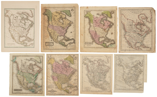
Title: America Author: Laurie, Robert and James Whittle Place: London Publisher: Robt. Laurie & Jas. Whittle Date: 1st July 1812 Description: Engraved map, hand-colored. 80x61.5 cm (31½x21¼), backed with linen and sectioned for folding into original pastepaper over boards slipcase labeled "America." Well-engraved map of North and South America, with attractive coloring. Warren Heckrotte points out some geographically significant features: "The representation of the Missouri is interesting. Up to the great bend he seems to have followed Arrowsmith. And beyond that he shows Arrowsmith's dotted line representation of the Missouri to the Rockies, which Laurie & Whittle characterize as 'former conjectures.' They then show in solid line the Missouri proceeding west identified as 'River Missouri of Capt Lewis.' But to this they have added Soulard's representation of the Missouri with the great northern loop. Beyond that they have added the Gallatin, Madison and Jefferson as on the map in the 1809 Lewis and Clark and the map with the 1810 French Gass." Provenance: Butterfield & Butterfield, 12/16/96 References: Wheat lists a map of Pinkerton's North America, no. 311, which from his description appears to represent the Missouri as this map does. Pinkerton's map is dated June 25th, 1812. John Thompson's map of North America, 1814, is similar. Lot Amendments Condition: Slipcase rubbed with some water damage; back of the map with dampstaining but noticably affecting the front, though there is some light soiling and discoloration; very good. Item number: 265994
Title: America Author: Laurie, Robert and James Whittle Place: London Publisher: Robt. Laurie & Jas. Whittle Date: 1st July 1812 Description: Engraved map, hand-colored. 80x61.5 cm (31½x21¼), backed with linen and sectioned for folding into original pastepaper over boards slipcase labeled "America." Well-engraved map of North and South America, with attractive coloring. Warren Heckrotte points out some geographically significant features: "The representation of the Missouri is interesting. Up to the great bend he seems to have followed Arrowsmith. And beyond that he shows Arrowsmith's dotted line representation of the Missouri to the Rockies, which Laurie & Whittle characterize as 'former conjectures.' They then show in solid line the Missouri proceeding west identified as 'River Missouri of Capt Lewis.' But to this they have added Soulard's representation of the Missouri with the great northern loop. Beyond that they have added the Gallatin, Madison and Jefferson as on the map in the 1809 Lewis and Clark and the map with the 1810 French Gass." Provenance: Butterfield & Butterfield, 12/16/96 References: Wheat lists a map of Pinkerton's North America, no. 311, which from his description appears to represent the Missouri as this map does. Pinkerton's map is dated June 25th, 1812. John Thompson's map of North America, 1814, is similar. Lot Amendments Condition: Slipcase rubbed with some water damage; back of the map with dampstaining but noticably affecting the front, though there is some light soiling and discoloration; very good. Item number: 265994


Testen Sie LotSearch und seine Premium-Features 7 Tage - ohne Kosten!
Lassen Sie sich automatisch über neue Objekte in kommenden Auktionen benachrichtigen.
Suchauftrag anlegen