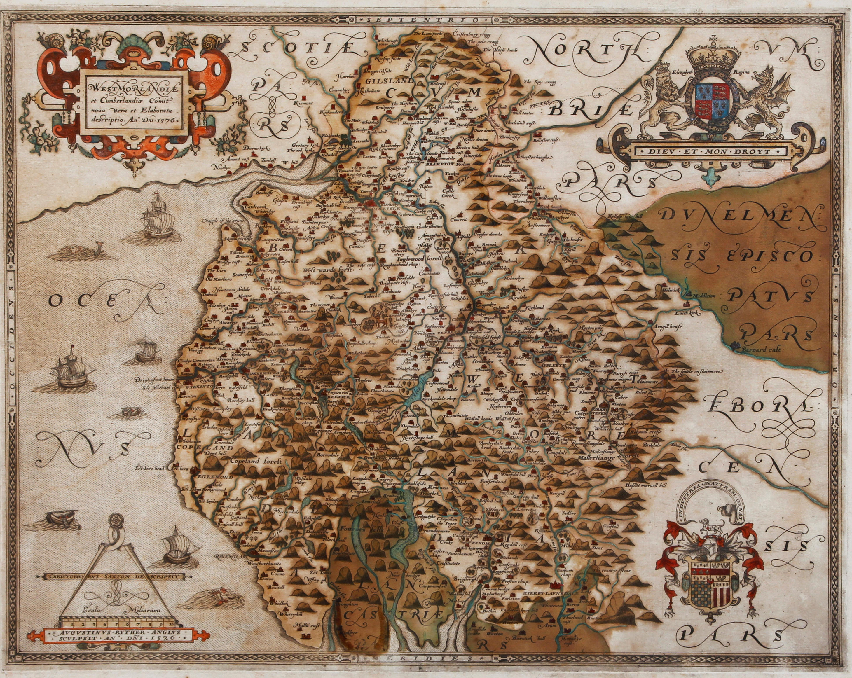
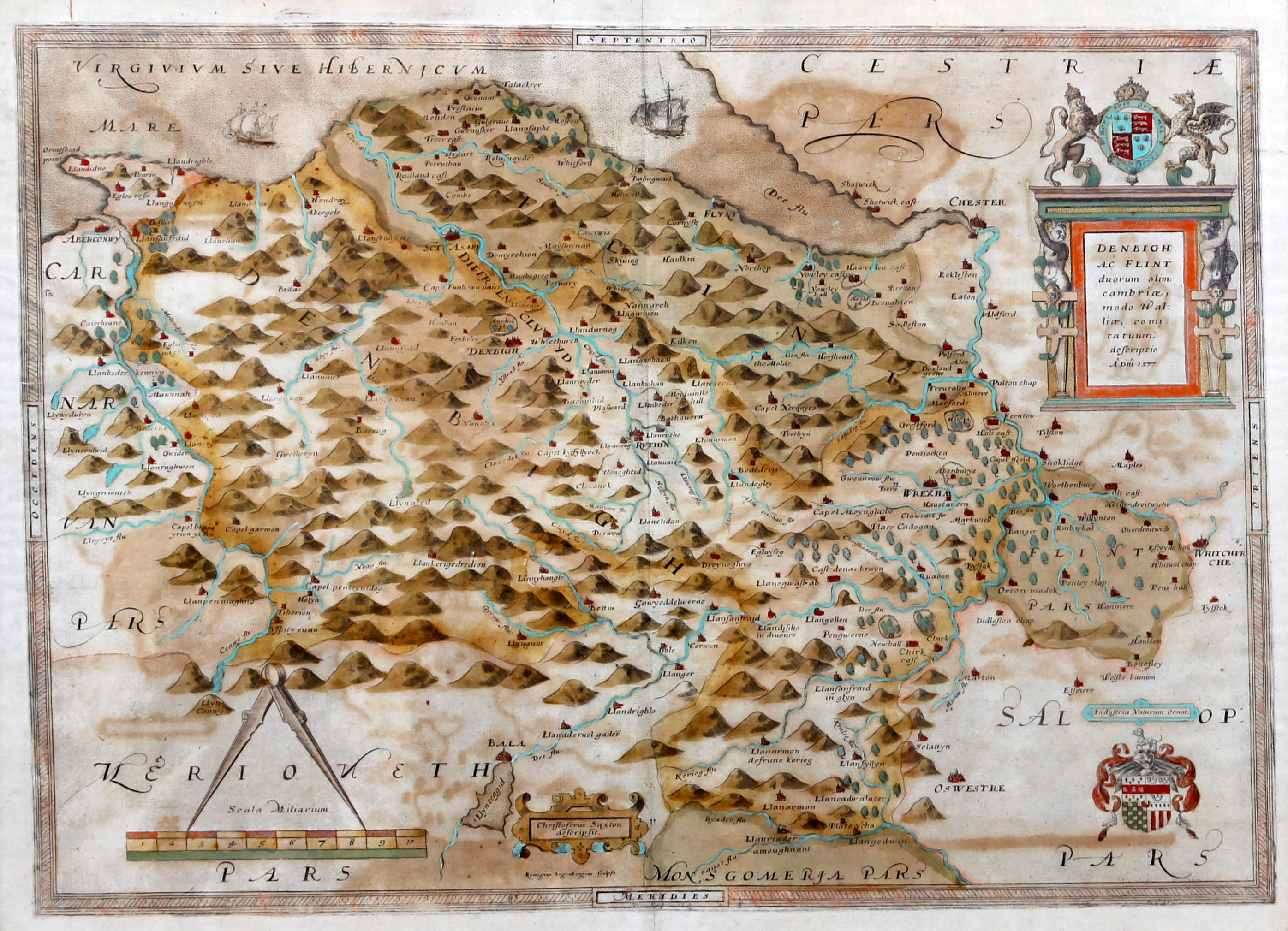
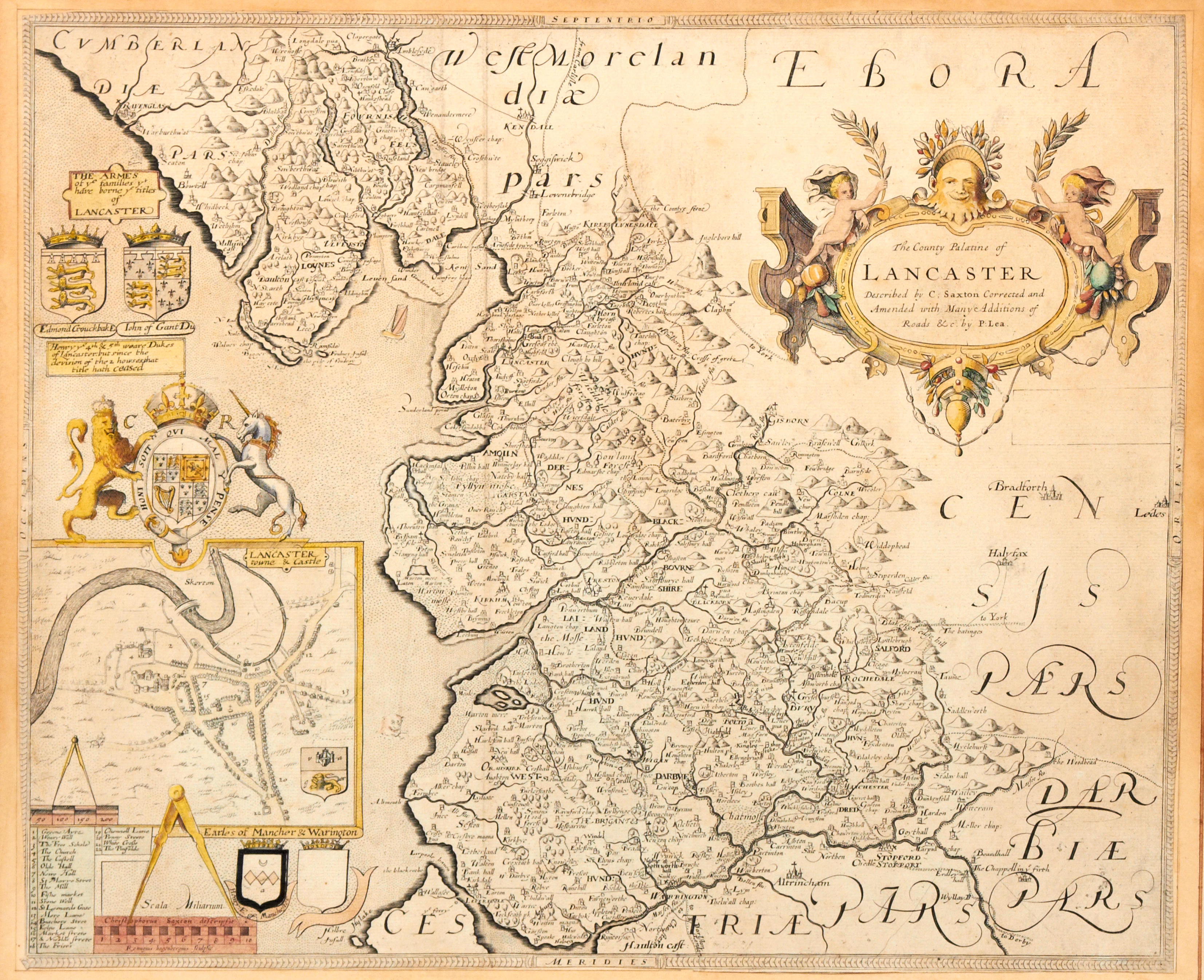
SAXTON, Christopher (c.1542-1606) and Philip LEA (d.1700). The Shires of England and Wales... Being the Best and Original Mapps with many Additions and Corrections Viz: y e Hund d s, Roads.. by Philip Lea . London: Philip Lea, [c.1693]. 2° (442 x 290mm). Engraved title, 46 double-page engraved maps, hand-coloured in outline, the New Map of England and Wales on 4 sheets joined and folding, the map of Yorkshire on 2 sheets joined and folding, and 2 others folding, maps numbered in manuscript 1 to 46, with three additional maps including Robert Morden's Sea Coast of Europe and ye Straits , Blaeu's map of Scotland after Robert Gordon and William Petty's map of Ireland, letterpress leaf bearing table of distances from London ( The Cities and Principal Towns in England and Wales ) laid down on recto of Isle of Wight map, mounted on guards throughout. (Minor marginal wear to title, a few small repairs or short tears with slight loss to folding maps, some light browning to Yorkshire map.) Contemporary panelled calf (corners slightly bumped, the spine showing signs of old restoration, some wear). A composite copy of Philip Lea's second reissue of Saxton's founding county atlas. Lea acquired the copper plates of Saxton's surveys of England and Wales, probably in their 1655 state, around 1680 and having reworked them, reissued the atlas in c.1689 and c.1693. His alterations included the addition of geographical and decorative features, which by 1693 included the completion of the hundreds, roads, town plans and coats-of-arms. Lea did not acquire the Saxton plates of Devonshire and Northumberland, replacing them with new ones, one engraved by Francis Lamb. The present copy accords with the 1693 edition as identified by Skelton (112), with the Royal initials changed to 'WR' and the new plate of Kent engraved for Lea c.1690 and dedicated to John Tillotson as Archbishop of Canterbury from 1691-1694. The maps of Hertfordshire and Middlesex (by Ogilby) are in variant states, and the Essex map, which did not appear in Lea's earlier reissue, reappears here. Cf. Skelton 112, which includes the map of 'Townes Villages... for 20 Miles Round London' present in some copies, not present here; not in Chubb or Wing.
SAXTON, Christopher (c.1542-1606) and Philip LEA (d.1700). The Shires of England and Wales... Being the Best and Original Mapps with many Additions and Corrections Viz: y e Hund d s, Roads.. by Philip Lea . London: Philip Lea, [c.1693]. 2° (442 x 290mm). Engraved title, 46 double-page engraved maps, hand-coloured in outline, the New Map of England and Wales on 4 sheets joined and folding, the map of Yorkshire on 2 sheets joined and folding, and 2 others folding, maps numbered in manuscript 1 to 46, with three additional maps including Robert Morden's Sea Coast of Europe and ye Straits , Blaeu's map of Scotland after Robert Gordon and William Petty's map of Ireland, letterpress leaf bearing table of distances from London ( The Cities and Principal Towns in England and Wales ) laid down on recto of Isle of Wight map, mounted on guards throughout. (Minor marginal wear to title, a few small repairs or short tears with slight loss to folding maps, some light browning to Yorkshire map.) Contemporary panelled calf (corners slightly bumped, the spine showing signs of old restoration, some wear). A composite copy of Philip Lea's second reissue of Saxton's founding county atlas. Lea acquired the copper plates of Saxton's surveys of England and Wales, probably in their 1655 state, around 1680 and having reworked them, reissued the atlas in c.1689 and c.1693. His alterations included the addition of geographical and decorative features, which by 1693 included the completion of the hundreds, roads, town plans and coats-of-arms. Lea did not acquire the Saxton plates of Devonshire and Northumberland, replacing them with new ones, one engraved by Francis Lamb. The present copy accords with the 1693 edition as identified by Skelton (112), with the Royal initials changed to 'WR' and the new plate of Kent engraved for Lea c.1690 and dedicated to John Tillotson as Archbishop of Canterbury from 1691-1694. The maps of Hertfordshire and Middlesex (by Ogilby) are in variant states, and the Essex map, which did not appear in Lea's earlier reissue, reappears here. Cf. Skelton 112, which includes the map of 'Townes Villages... for 20 Miles Round London' present in some copies, not present here; not in Chubb or Wing.

.jpg)
.jpg)


Testen Sie LotSearch und seine Premium-Features 7 Tage - ohne Kosten!
Lassen Sie sich automatisch über neue Objekte in kommenden Auktionen benachrichtigen.
Suchauftrag anlegen