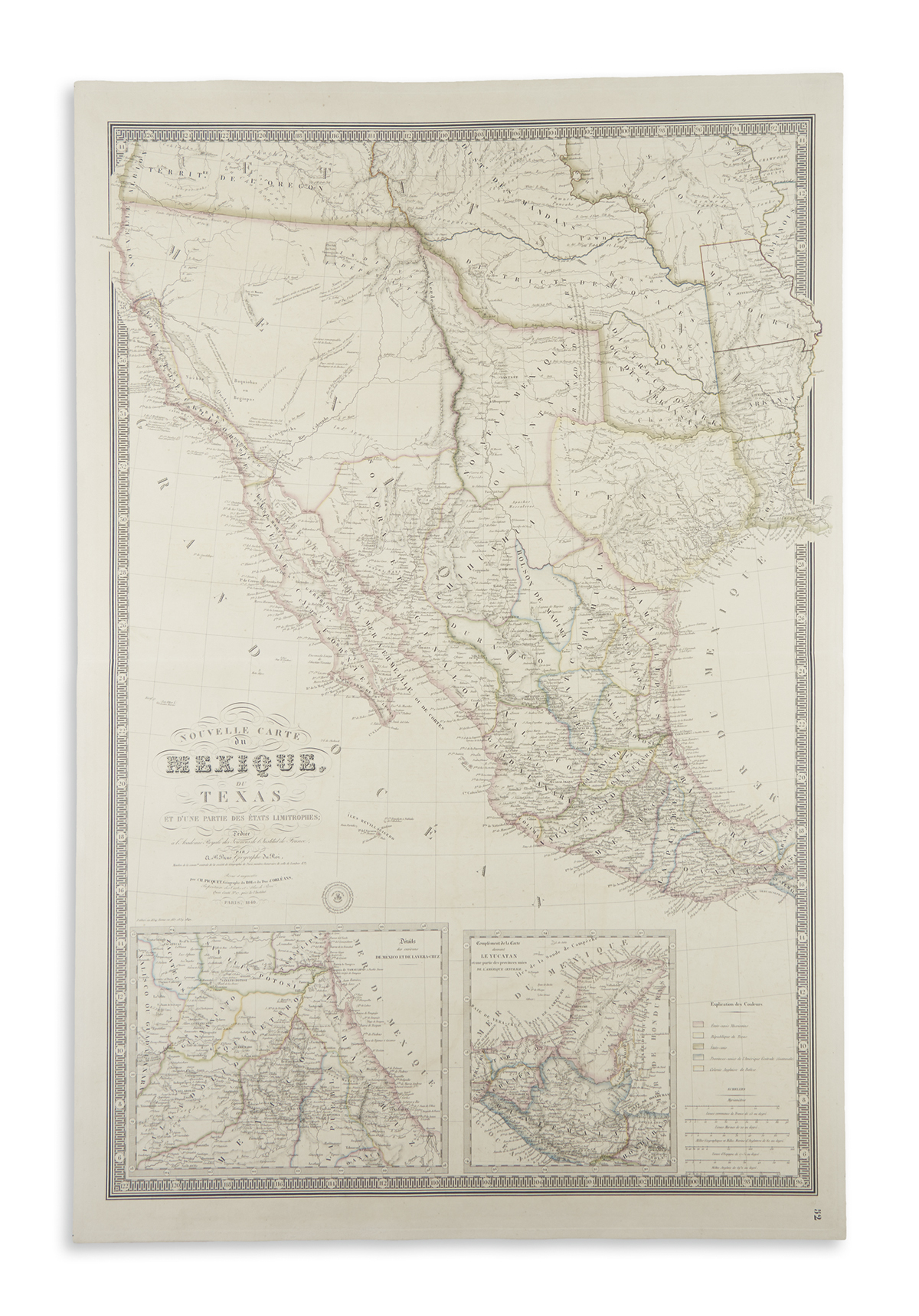
Title: Nouvelle Carte du Mexique, Du Texas Et D'Une Partie Des États Limitrophes; Dediée á l'Acadamie Royale des Sciences de l'Institute de France, Par A. H. Brué, Géographe du Roi... Revue et augmentée par Ch. Picquet, Géographe du Roi et du Duc d'Orléans Author: Brué, Adrien Hubert Place: Paris Publisher: Ch. Picquet Date: 1845 Description: Engraved map, hand-colored in outline, with key to colors. 93.5x62.5 cm (36¾x24½"). Large and beautifully-engraved map of Mexico and the present southwest of the United States, at a time of transition and coming conquest. Warren Heckrotte comments on it at some length: "This is the fifth edition. The first was issued in 1834, chez Brué's widow. The first issue is important for it is the first cartographic representation of Jedediah Smith's journey to California and return in 1826... There are many changes in this later edition compared with the 1834 edition. Rumsey found no differences between the 1834 and 1837 edition. Differences between this and the 1840 issue are noted below. The upper part of the Great Basin and northern California follows Arrowsmith's 1834 map of British America. He shows by color and text the Russian establishment in northern California (though by this time the Russians had sold out to Sutter). Two large Tule Lakes are shown in the lower Central Valley of California; Tanner's map of North America, 1836, shows two Tule Lakes much the same. There are many additions in Texas; according to Arkway Cat. 63, the mapping is based on the 1839 issue of Stephen Austin's map of Texas. The legend designating colors has Republique du Texas, but the map is so colored to indicate that Texas is now part of the U.S. Changes from the 1840 edition (based on comparison with reproduction in Arkway Cat. 63): Under Explications des Couleurs, Establisseement Russe has been added. Above R. Slavianka Ross, Estabt. Russe had been added in block letters and the area colored green. Along Sacramento River, Nlle. Helvetia has been added. Just below Oregon border the words 'Limite d'apres le traité de Washington (Fevrier 1819)' has been removed (these words are also on the first edition). There are probably other changes that I can't detect because of the size of the reproduction. " Further Notes from the Files of Warren Heckrotte Full title: Nouvelle Carte | du | Mexique, | Du | Texas | Et D'Une Partie Des États Limitrophes; Dediée | á l'Acadamie Royale des Sciences de l Institute de France, | Par | A. H. Brué, | Géographe du Roi, | Membre de la comm.on centrale de la societé de Géographie de Paris, membre-honoraire de celle de Londres, &a. | Revue et augmentée | par Ch. Picquet, Géographe du Roi et du Duc d'Orléans, | Propriétaire des Cartes et Atlas de Brué, | Quai Conti No. 17, près de l'Institut.| Paris, 1845 || Publiée en 1834, 1837, 1839, 1840, 1845. || Seal of Brué, upon which is blindstamped Ch. Picquet, 17 Q. Conti A Paris, and over printed, Propriéte Acquise en 1835.|| Explications des Couleurs [six colors indicated, including one for Texas, and one for Establissement Russe] || Echelles [six linear scales] || Inset 1: Détails des environs De México et de la Vera-Cruz. Inset 2: Complement de la Carte donnant Le Yucatan et une partie des provinces unies de L'Amérique Centrale.|| [in margin:] 53 Provenance: Jonathan Potter, 7/02 Six scales: Myriamétres; common French leagues, 25 to a degree; marine leagues, 20 to a degree; miles in 60 to a degree; and Spanish leagures, 17 1/2 to a degree; English miles, 69 1/2 to a degree. Scale in ordinary miles, about 26 miles to one inch. References: W-TW 404 (R), 1834 ed. Morgan and Wheat, 1834 ed. Orozco y Berra, no 494 Lot Amendments Condition: Paper slightly toned, some light offsetting, a short marginal tear; very good or better, a handsome map, rare, at least in the market. Item number: 265118
Title: Nouvelle Carte du Mexique, Du Texas Et D'Une Partie Des États Limitrophes; Dediée á l'Acadamie Royale des Sciences de l'Institute de France, Par A. H. Brué, Géographe du Roi... Revue et augmentée par Ch. Picquet, Géographe du Roi et du Duc d'Orléans Author: Brué, Adrien Hubert Place: Paris Publisher: Ch. Picquet Date: 1845 Description: Engraved map, hand-colored in outline, with key to colors. 93.5x62.5 cm (36¾x24½"). Large and beautifully-engraved map of Mexico and the present southwest of the United States, at a time of transition and coming conquest. Warren Heckrotte comments on it at some length: "This is the fifth edition. The first was issued in 1834, chez Brué's widow. The first issue is important for it is the first cartographic representation of Jedediah Smith's journey to California and return in 1826... There are many changes in this later edition compared with the 1834 edition. Rumsey found no differences between the 1834 and 1837 edition. Differences between this and the 1840 issue are noted below. The upper part of the Great Basin and northern California follows Arrowsmith's 1834 map of British America. He shows by color and text the Russian establishment in northern California (though by this time the Russians had sold out to Sutter). Two large Tule Lakes are shown in the lower Central Valley of California; Tanner's map of North America, 1836, shows two Tule Lakes much the same. There are many additions in Texas; according to Arkway Cat. 63, the mapping is based on the 1839 issue of Stephen Austin's map of Texas. The legend designating colors has Republique du Texas, but the map is so colored to indicate that Texas is now part of the U.S. Changes from the 1840 edition (based on comparison with reproduction in Arkway Cat. 63): Under Explications des Couleurs, Establisseement Russe has been added. Above R. Slavianka Ross, Estabt. Russe had been added in block letters and the area colored green. Along Sacramento River, Nlle. Helvetia has been added. Just below Oregon border the words 'Limite d'apres le traité de Washington (Fevrier 1819)' has been removed (these words are also on the first edition). There are probably other changes that I can't detect because of the size of the reproduction. " Further Notes from the Files of Warren Heckrotte Full title: Nouvelle Carte | du | Mexique, | Du | Texas | Et D'Une Partie Des États Limitrophes; Dediée | á l'Acadamie Royale des Sciences de l Institute de France, | Par | A. H. Brué, | Géographe du Roi, | Membre de la comm.on centrale de la societé de Géographie de Paris, membre-honoraire de celle de Londres, &a. | Revue et augmentée | par Ch. Picquet, Géographe du Roi et du Duc d'Orléans, | Propriétaire des Cartes et Atlas de Brué, | Quai Conti No. 17, près de l'Institut.| Paris, 1845 || Publiée en 1834, 1837, 1839, 1840, 1845. || Seal of Brué, upon which is blindstamped Ch. Picquet, 17 Q. Conti A Paris, and over printed, Propriéte Acquise en 1835.|| Explications des Couleurs [six colors indicated, including one for Texas, and one for Establissement Russe] || Echelles [six linear scales] || Inset 1: Détails des environs De México et de la Vera-Cruz. Inset 2: Complement de la Carte donnant Le Yucatan et une partie des provinces unies de L'Amérique Centrale.|| [in margin:] 53 Provenance: Jonathan Potter, 7/02 Six scales: Myriamétres; common French leagues, 25 to a degree; marine leagues, 20 to a degree; miles in 60 to a degree; and Spanish leagures, 17 1/2 to a degree; English miles, 69 1/2 to a degree. Scale in ordinary miles, about 26 miles to one inch. References: W-TW 404 (R), 1834 ed. Morgan and Wheat, 1834 ed. Orozco y Berra, no 494 Lot Amendments Condition: Paper slightly toned, some light offsetting, a short marginal tear; very good or better, a handsome map, rare, at least in the market. Item number: 265118


Testen Sie LotSearch und seine Premium-Features 7 Tage - ohne Kosten!
Lassen Sie sich automatisch über neue Objekte in kommenden Auktionen benachrichtigen.
Suchauftrag anlegen