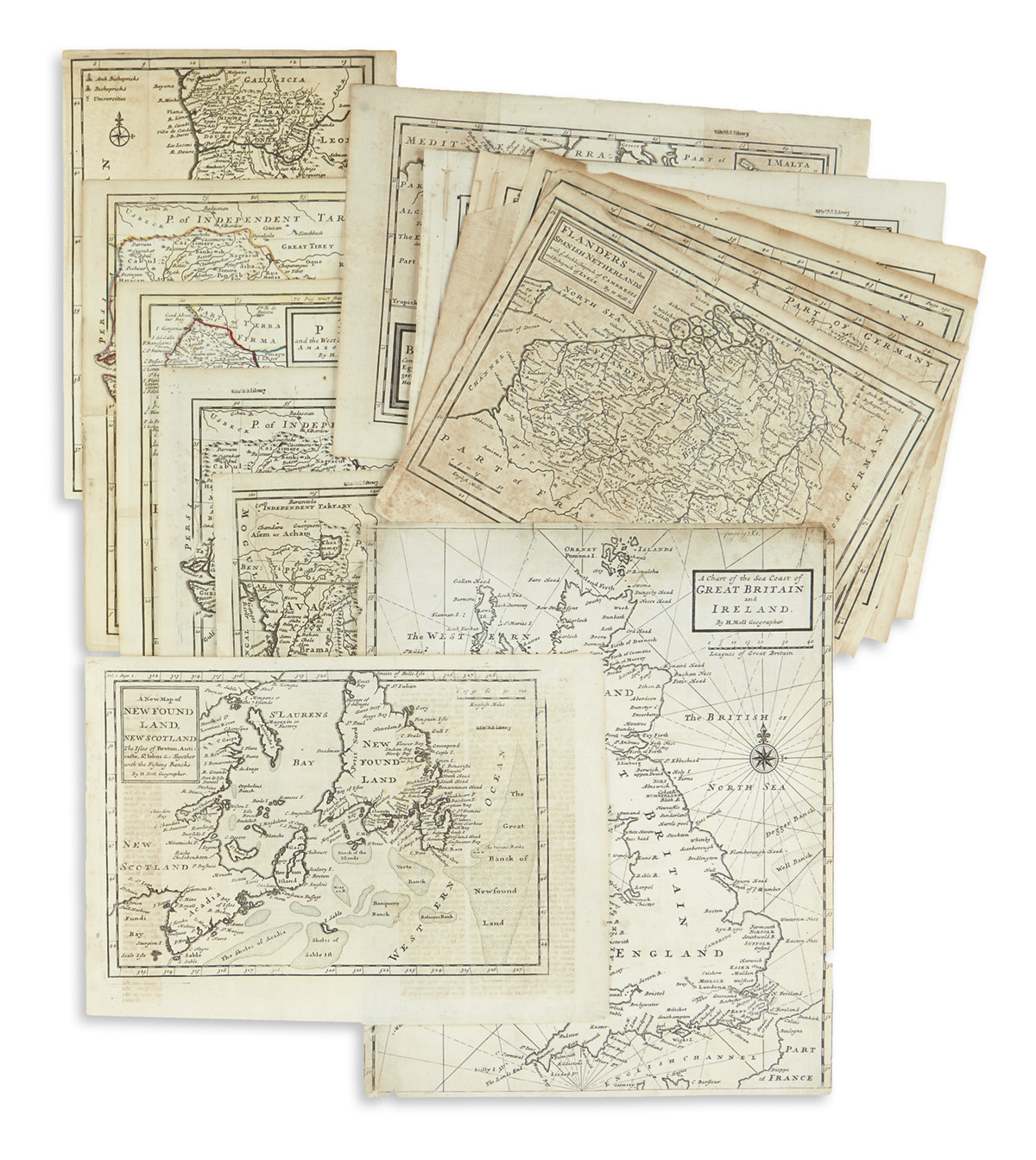
MOLL, Herman. A group of nine maps of Europe, like from Catalogue of a New and Compleat Set of Twenty-Five Two-Sheet Maps, including: Map of Muscovy, Poland, Little Tartary, and the Black Sea, &c . [London:] H. Moll, D. Midwinter, P. Overton, and T. Bowles, n.d. [ca 1730]. Engraved map, on two joined sheets, 630 x 1004 mm, hand-colored in outline, dedication to Peter Alexovitz, Lord of Russia, within elaborate engraved vignette along right side. Matted. -- A New Map of the Baltick &c . [London], n.d. [ca 1730]. Engraved map, on two joined sheets, 568 x 640 mm, hand-colored outline, inset map of a chart of the Sound or Passes into the Baltic Seas. (Reinforced along folds.) Matted. -- A New Map of Germany. Hungary. Transylvania & the Suisse Cantons... 1712 . [London:] Printed for H. Moll, J. Bowles, P. Overton and John King [ca 1730]. Engraved map, on two joined sheets, 612 x 1005 mm, hand-colored in outline. (Vertical folds skillfully repaired in places.) Matted. -- A New and Exact Map of France. [London:] Printed for H. Moll, J. Bowles, P. Overton, T. Bowles, and John King [ca 1730]. Engraved map, on two joined sheets, 650 x 970 mm, hand-colored in outline. Matted. -- A New Map of Denmark and Sweden . [London:] Printed for H. Moll, John Bowles Thomas Bowles and Philip Overton, [ca 1730]. Engraved map, on two joined sheets, 605 x 1010 mm, hand-colored in outline, title and dedication to John Lord Bishop of Bristol. (Vertical creases lightly browned.) Matted. -- A New & Exact Map of the Electorate of Brunswick-Lunenburg . [London]: Sold by Herman Moll and Philip Overton, [ca 1730]. Engraved map, on two joined sheets, 612 x 1015 mm, hand-colored in outline. (One or two spots.) Matted. --Another copy. (Joint and vertical fold repaired.) Matted. -- A New and Exact Map of the United Provinces, or Netherlands . [London:] John Bowles T. Bowles, and John King n.d. [ca 1730]. Engraved map, on two joined sheets, 632 x 1034 mm, hand-colored in outline. (Reinforced along folds.) Matted. -- Les Provinces des Pays-Bas Catholiques ou A Most Exact Map of Flanders or Austrian Netherlands . London: H. Moll, J. Bowles & Son, T. Bowles, and John King n.d. [ca 1730]. Engraved map, on two joined sheets, 638 x 1028 mm, hand-colored in outline. (Reinforced along folds.) Matted. -- [ With: ] De L'ISLE, Guillaume (1675-1726). The Seat of War on the Rhine being a New Map of the Course of that River from Strasbourg to Bonn... [London]: Printed for T. Bowles & J. Bowles, [n.d.]. Engraved map, on two joined sheets, 942 x 590 mm, hand-colored in outline. (Horizontal folds lightly browned.) Matted. Together 10 items. (10)
MOLL, Herman. A group of nine maps of Europe, like from Catalogue of a New and Compleat Set of Twenty-Five Two-Sheet Maps, including: Map of Muscovy, Poland, Little Tartary, and the Black Sea, &c . [London:] H. Moll, D. Midwinter, P. Overton, and T. Bowles, n.d. [ca 1730]. Engraved map, on two joined sheets, 630 x 1004 mm, hand-colored in outline, dedication to Peter Alexovitz, Lord of Russia, within elaborate engraved vignette along right side. Matted. -- A New Map of the Baltick &c . [London], n.d. [ca 1730]. Engraved map, on two joined sheets, 568 x 640 mm, hand-colored outline, inset map of a chart of the Sound or Passes into the Baltic Seas. (Reinforced along folds.) Matted. -- A New Map of Germany. Hungary. Transylvania & the Suisse Cantons... 1712 . [London:] Printed for H. Moll, J. Bowles, P. Overton and John King [ca 1730]. Engraved map, on two joined sheets, 612 x 1005 mm, hand-colored in outline. (Vertical folds skillfully repaired in places.) Matted. -- A New and Exact Map of France. [London:] Printed for H. Moll, J. Bowles, P. Overton, T. Bowles, and John King [ca 1730]. Engraved map, on two joined sheets, 650 x 970 mm, hand-colored in outline. Matted. -- A New Map of Denmark and Sweden . [London:] Printed for H. Moll, John Bowles Thomas Bowles and Philip Overton, [ca 1730]. Engraved map, on two joined sheets, 605 x 1010 mm, hand-colored in outline, title and dedication to John Lord Bishop of Bristol. (Vertical creases lightly browned.) Matted. -- A New & Exact Map of the Electorate of Brunswick-Lunenburg . [London]: Sold by Herman Moll and Philip Overton, [ca 1730]. Engraved map, on two joined sheets, 612 x 1015 mm, hand-colored in outline. (One or two spots.) Matted. --Another copy. (Joint and vertical fold repaired.) Matted. -- A New and Exact Map of the United Provinces, or Netherlands . [London:] John Bowles T. Bowles, and John King n.d. [ca 1730]. Engraved map, on two joined sheets, 632 x 1034 mm, hand-colored in outline. (Reinforced along folds.) Matted. -- Les Provinces des Pays-Bas Catholiques ou A Most Exact Map of Flanders or Austrian Netherlands . London: H. Moll, J. Bowles & Son, T. Bowles, and John King n.d. [ca 1730]. Engraved map, on two joined sheets, 638 x 1028 mm, hand-colored in outline. (Reinforced along folds.) Matted. -- [ With: ] De L'ISLE, Guillaume (1675-1726). The Seat of War on the Rhine being a New Map of the Course of that River from Strasbourg to Bonn... [London]: Printed for T. Bowles & J. Bowles, [n.d.]. Engraved map, on two joined sheets, 942 x 590 mm, hand-colored in outline. (Horizontal folds lightly browned.) Matted. Together 10 items. (10)
MOLL, Herman. A group of nine maps of Europe, like from Catalogue of a New and Compleat Set of Twenty-Five Two-Sheet Maps, including: Map of Muscovy, Poland, Little Tartary, and the Black Sea, &c . [London:] H. Moll, D. Midwinter, P. Overton, and T. Bowles, n.d. [ca 1730]. Engraved map, on two joined sheets, 630 x 1004 mm, hand-colored in outline, dedication to Peter Alexovitz, Lord of Russia, within elaborate engraved vignette along right side. Matted. -- A New Map of the Baltick &c . [London], n.d. [ca 1730]. Engraved map, on two joined sheets, 568 x 640 mm, hand-colored outline, inset map of a chart of the Sound or Passes into the Baltic Seas. (Reinforced along folds.) Matted. -- A New Map of Germany. Hungary. Transylvania & the Suisse Cantons... 1712 . [London:] Printed for H. Moll, J. Bowles, P. Overton and John King [ca 1730]. Engraved map, on two joined sheets, 612 x 1005 mm, hand-colored in outline. (Vertical folds skillfully repaired in places.) Matted. -- A New and Exact Map of France. [London:] Printed for H. Moll, J. Bowles, P. Overton, T. Bowles, and John King [ca 1730]. Engraved map, on two joined sheets, 650 x 970 mm, hand-colored in outline. Matted. -- A New Map of Denmark and Sweden . [London:] Printed for H. Moll, John Bowles Thomas Bowles and Philip Overton, [ca 1730]. Engraved map, on two joined sheets, 605 x 1010 mm, hand-colored in outline, title and dedication to John Lord Bishop of Bristol. (Vertical creases lightly browned.) Matted. -- A New & Exact Map of the Electorate of Brunswick-Lunenburg . [London]: Sold by Herman Moll and Philip Overton, [ca 1730]. Engraved map, on two joined sheets, 612 x 1015 mm, hand-colored in outline. (One or two spots.) Matted. --Another copy. (Joint and vertical fold repaired.) Matted. -- A New and Exact Map of the United Provinces, or Netherlands . [London:] John Bowles T. Bowles, and John King n.d. [ca 1730]. Engraved map, on two joined sheets, 632 x 1034 mm, hand-colored in outline. (Reinforced along folds.) Matted. -- Les Provinces des Pays-Bas Catholiques ou A Most Exact Map of Flanders or Austrian Netherlands . London: H. Moll, J. Bowles & Son, T. Bowles, and John King n.d. [ca 1730]. Engraved map, on two joined sheets, 638 x 1028 mm, hand-colored in outline. (Reinforced along folds.) Matted. -- [ With: ] De L'ISLE, Guillaume (1675-1726). The Seat of War on the Rhine being a New Map of the Course of that River from Strasbourg to Bonn... [London]: Printed for T. Bowles & J. Bowles, [n.d.]. Engraved map, on two joined sheets, 942 x 590 mm, hand-colored in outline. (Horizontal folds lightly browned.) Matted. Together 10 items. (10)
MOLL, Herman. A group of nine maps of Europe, like from Catalogue of a New and Compleat Set of Twenty-Five Two-Sheet Maps, including: Map of Muscovy, Poland, Little Tartary, and the Black Sea, &c . [London:] H. Moll, D. Midwinter, P. Overton, and T. Bowles, n.d. [ca 1730]. Engraved map, on two joined sheets, 630 x 1004 mm, hand-colored in outline, dedication to Peter Alexovitz, Lord of Russia, within elaborate engraved vignette along right side. Matted. -- A New Map of the Baltick &c . [London], n.d. [ca 1730]. Engraved map, on two joined sheets, 568 x 640 mm, hand-colored outline, inset map of a chart of the Sound or Passes into the Baltic Seas. (Reinforced along folds.) Matted. -- A New Map of Germany. Hungary. Transylvania & the Suisse Cantons... 1712 . [London:] Printed for H. Moll, J. Bowles, P. Overton and John King [ca 1730]. Engraved map, on two joined sheets, 612 x 1005 mm, hand-colored in outline. (Vertical folds skillfully repaired in places.) Matted. -- A New and Exact Map of France. [London:] Printed for H. Moll, J. Bowles, P. Overton, T. Bowles, and John King [ca 1730]. Engraved map, on two joined sheets, 650 x 970 mm, hand-colored in outline. Matted. -- A New Map of Denmark and Sweden . [London:] Printed for H. Moll, John Bowles Thomas Bowles and Philip Overton, [ca 1730]. Engraved map, on two joined sheets, 605 x 1010 mm, hand-colored in outline, title and dedication to John Lord Bishop of Bristol. (Vertical creases lightly browned.) Matted. -- A New & Exact Map of the Electorate of Brunswick-Lunenburg . [London]: Sold by Herman Moll and Philip Overton, [ca 1730]. Engraved map, on two joined sheets, 612 x 1015 mm, hand-colored in outline. (One or two spots.) Matted. --Another copy. (Joint and vertical fold repaired.) Matted. -- A New and Exact Map of the United Provinces, or Netherlands . [London:] John Bowles T. Bowles, and John King n.d. [ca 1730]. Engraved map, on two joined sheets, 632 x 1034 mm, hand-colored in outline. (Reinforced along folds.) Matted. -- Les Provinces des Pays-Bas Catholiques ou A Most Exact Map of Flanders or Austrian Netherlands . London: H. Moll, J. Bowles & Son, T. Bowles, and John King n.d. [ca 1730]. Engraved map, on two joined sheets, 638 x 1028 mm, hand-colored in outline. (Reinforced along folds.) Matted. -- [ With: ] De L'ISLE, Guillaume (1675-1726). The Seat of War on the Rhine being a New Map of the Course of that River from Strasbourg to Bonn... [London]: Printed for T. Bowles & J. Bowles, [n.d.]. Engraved map, on two joined sheets, 942 x 590 mm, hand-colored in outline. (Horizontal folds lightly browned.) Matted. Together 10 items. (10)


Testen Sie LotSearch und seine Premium-Features 7 Tage - ohne Kosten!
Lassen Sie sich automatisch über neue Objekte in kommenden Auktionen benachrichtigen.
Suchauftrag anlegen