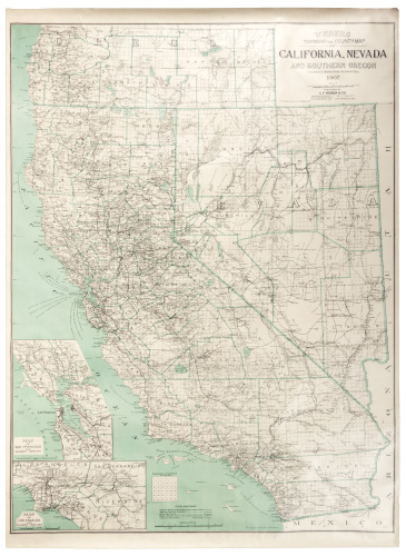
Title: Map of Southern Oregon and Northern California Compiled From the best Authorities, and from personal surveys and explorations, exhibiting a reliable view of the rich Gold Region of the North, as well as the mineral region of middle California Embracing also a corrected chart of the coast from San Francisco bay, to the Columbia River agreably [sic] to the late United States Coast Survey Author: Scholfield, Nathan Place: San Francisco Publisher: Marvin & Hitchcock Date: 1851 Description: Lithographed map. Lith. by J.W. Hartman. 57.7x43.4 cm (23½x17"). Rare map of northern California and much of present Oregon. Wheat notes that "The map extends from the Columbia River on the north to San Francisco on the south. It correctly shows the Trinity River flowing into the Klamath at some distance from the sea. It also contains a line, denoted 'Western Line of the Gold Country,' extending from the mouth of 'Redwoods Creek,' north of Eureka, in a southeasterly direction, and thence easterly (south of Cottonwood Creek) to the Sacramento, thence northeasterly and again southeasterly to the Feather River. 'One House Town' appears on Clear Creek, southwest of Shasta City. Schofield's map is one of the most interesting, as well as one of the earliest, attempts to represent the newly explored Trinity and Klamath river diggings." OCLC/WorldCat locates only four copies of the map, at the University of California Santa Cruz, the Oregon Historical Society, Yale University, and the Huntington Library. Further Notes from the Files of Warren Heckrotte Full title: Map of Southern Oregon and Northern California Compiled From the best Authorities, and from personal surveys and explorations, exhibiting a reliable view of the rich Gold Region of the North, as well as the mineral region of middle California Embracing also a corrected chart of the coast from San Francisco bay, to the Columbia River agreably to the late United States Coast Survey By N. Scholfield, Civil Engineer. Lith. by J.W. Hartman San Francisco | Published by Marvin & Hitchcock, San Francisco. | Scale of Miles [linear scale] | Entered according to act of Congress, in June A. 1851, By Nathan Scholfield, in the Clerks office of the District Court for the Northern District of California. Provenance: Alta California Books, 1/67 References: W-GR 206 ( Rep ). W-TW 734 ( Rep). Streeter 2685. Ristow, American Maps and Mapmakers, p 454, Fig 27-5, ( Rep ). Lot Amendments Condition: Moderate browning to the paper, a bit of foxing, four waterstains, two of them in the Pacific Ocean on the left, two of them in areas of little detail on the right, none affecting the most important areas of the map details. Very good. Item number: 265043
Title: Map of Southern Oregon and Northern California Compiled From the best Authorities, and from personal surveys and explorations, exhibiting a reliable view of the rich Gold Region of the North, as well as the mineral region of middle California Embracing also a corrected chart of the coast from San Francisco bay, to the Columbia River agreably [sic] to the late United States Coast Survey Author: Scholfield, Nathan Place: San Francisco Publisher: Marvin & Hitchcock Date: 1851 Description: Lithographed map. Lith. by J.W. Hartman. 57.7x43.4 cm (23½x17"). Rare map of northern California and much of present Oregon. Wheat notes that "The map extends from the Columbia River on the north to San Francisco on the south. It correctly shows the Trinity River flowing into the Klamath at some distance from the sea. It also contains a line, denoted 'Western Line of the Gold Country,' extending from the mouth of 'Redwoods Creek,' north of Eureka, in a southeasterly direction, and thence easterly (south of Cottonwood Creek) to the Sacramento, thence northeasterly and again southeasterly to the Feather River. 'One House Town' appears on Clear Creek, southwest of Shasta City. Schofield's map is one of the most interesting, as well as one of the earliest, attempts to represent the newly explored Trinity and Klamath river diggings." OCLC/WorldCat locates only four copies of the map, at the University of California Santa Cruz, the Oregon Historical Society, Yale University, and the Huntington Library. Further Notes from the Files of Warren Heckrotte Full title: Map of Southern Oregon and Northern California Compiled From the best Authorities, and from personal surveys and explorations, exhibiting a reliable view of the rich Gold Region of the North, as well as the mineral region of middle California Embracing also a corrected chart of the coast from San Francisco bay, to the Columbia River agreably to the late United States Coast Survey By N. Scholfield, Civil Engineer. Lith. by J.W. Hartman San Francisco | Published by Marvin & Hitchcock, San Francisco. | Scale of Miles [linear scale] | Entered according to act of Congress, in June A. 1851, By Nathan Scholfield, in the Clerks office of the District Court for the Northern District of California. Provenance: Alta California Books, 1/67 References: W-GR 206 ( Rep ). W-TW 734 ( Rep). Streeter 2685. Ristow, American Maps and Mapmakers, p 454, Fig 27-5, ( Rep ). Lot Amendments Condition: Moderate browning to the paper, a bit of foxing, four waterstains, two of them in the Pacific Ocean on the left, two of them in areas of little detail on the right, none affecting the most important areas of the map details. Very good. Item number: 265043


Testen Sie LotSearch und seine Premium-Features 7 Tage - ohne Kosten!
Lassen Sie sich automatisch über neue Objekte in kommenden Auktionen benachrichtigen.
Suchauftrag anlegen