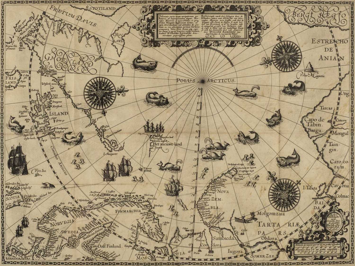
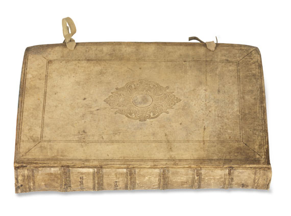
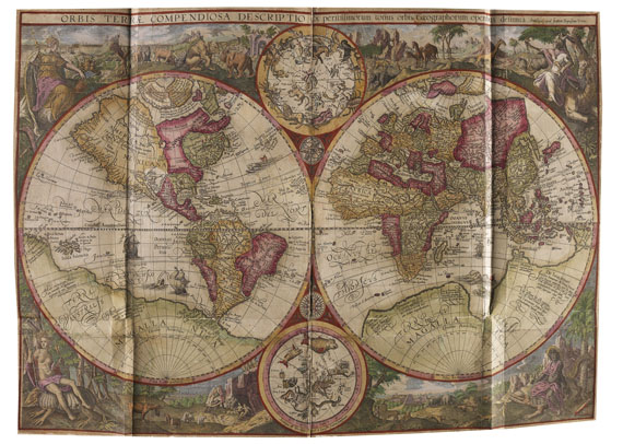
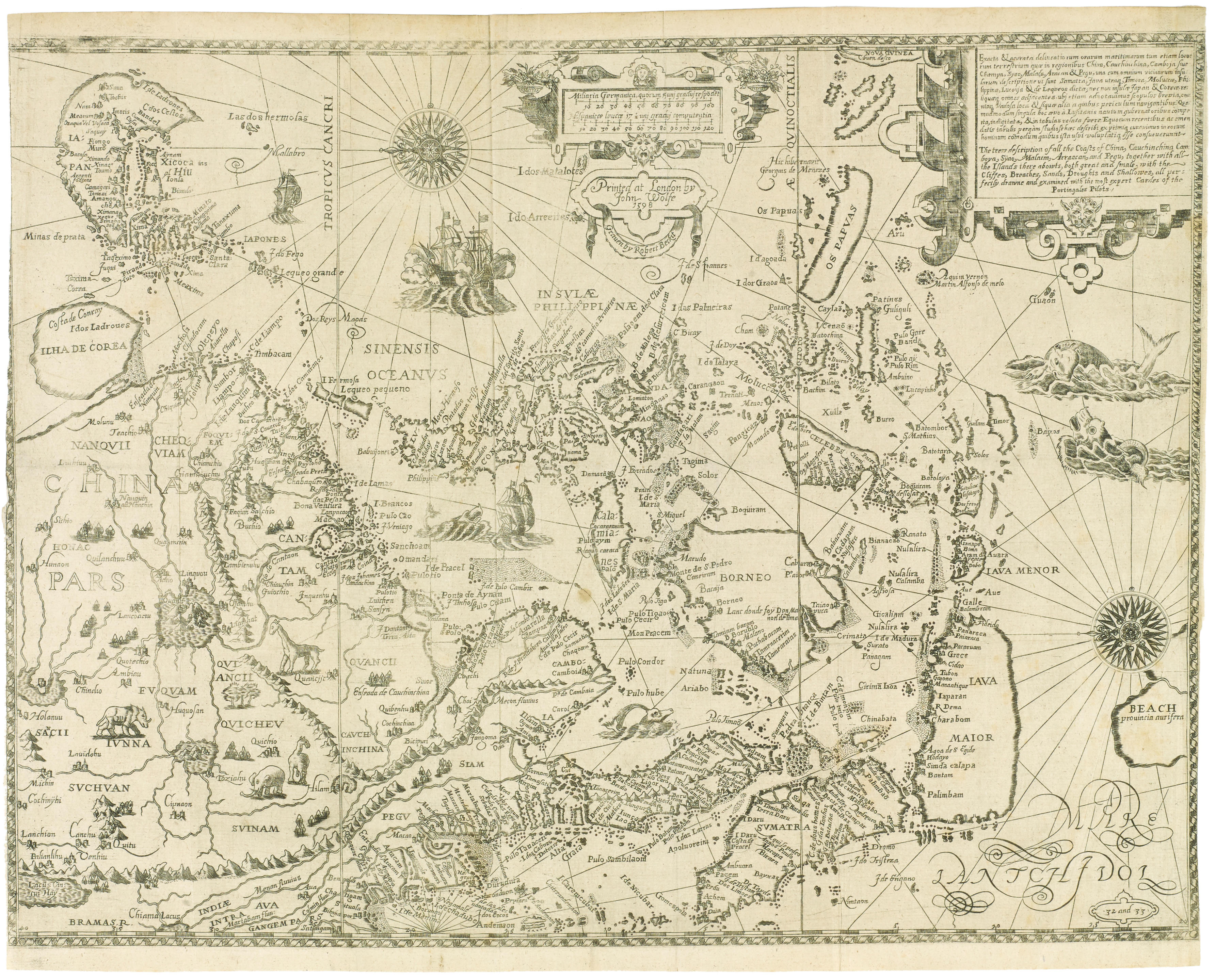
LINSCHOTEN, Jan Huyghen van (1563-1611). Navigatio ac itinerarium … in orientalem sive lusitanorum Indiam [part 2: Descriptio totius Guineae tractatus ]. The Hague: Albrecht Hendrickz. for the author and Cornelius Nicolaius, and sold by Gilles Elzevir, 1599. First Latin edition, and the first to include Barentsz' map of his voyage and the regions adjacent to the North Pole. Linschoten, a Dutchman born in Delft, was in Goa between 1583 and 1589, and with Willem Barentsz on his second voyage to the Kara Sea in 1594-1595. These experiences were recorded in the present work, which was first published in Dutch (Amsterdam: 1595-1596), and contains the most comprehensive account of the East and West Indies available at the end of the sixteenth century. In this 1599 edition, Jan van Doetecum the younger's engraving of Petrus Plancius's 1594 map (Shirley World 187) has been replaced with Arnold and Hendrik Florentsz. van Langren's version published by Jan Baptist Vrients (Shirley World 192; see front endpapers for illustration). This double-hemisphere map is notable for several reasons. Firstly, as Shirley notes, ‘there are differences affecting the northern seas, and the pictorial scenes forming the outer border have been regrouped with even greater stylistic effect.’ Secondly, it is the second-known map to definitely show Korea as a peninsula. Thirdly, the watermark, that of crossed arrows 90mm in length, is different to the other watermarks found on the other van Langren and van Doetecum maps and plates in the book (bunch of grapes terminating in initials I.S.). However, rather intriguingly, the crossed arrows watermark is also shared with the van Doetecum Arctic map of Barentsz’ voyage, present in this edition for the first time, which suggests that both the van Langren and van Doetecum families had a close association with Vrients in Antwerp, as well as Plancius in Amsterdam, and that Linschoten was sourcing engravings from different publishers in different cities. As well as including important travel accounts taken from contemporary Portuguese, Dutch and Spanish sources, it is the first work to include precise sailing instructions for the Indies, and also includes an account of America. It thus aided the development and establishment of an overseas Dutch trading empire. It yielded secrets about Portuguese sea routes to the east and about how their territories were governed; it was also of special value for its description of spice trees and spice growing areas. Very rare: we have only been able to trace 5 copies selling at auction over the past 40 years, two of which have been incomplete (ABPC/RBH). Adams L-735 (one incomplete copy in Cambridge); Brunet III, 1091; Howgego L131; Sabin 41366; New Hollstein Van Doetecum IV, 927-984. 2 parts in one volume, folio (310 x 200mm). Title to each part with large engraving of a ship, full-page engraved illustration of dedicatee's arms, full-page engraved portrait of the author with four small inset maps at corners, folding double-page engraved world map by Arnold and Hendrik van Langren after Jan Baptist Vrients (Shirley World 192), 2 single-page and 31 double-page maps, plates and views, of which 12 folding, 38 signed by Baptista van Doetecum and Jan van Doetecum the younger, the others by Arnold Florensz. van Langren, and Hendrik Florensz. van Langren, after Willem Barents, A.F. van Langren and Linschoten (title remargined, front free endpaper with large repaired chip, first few leaves creased at lower corner, one or two plates crumpled at edges, a few tiny holes at creasefolds but without any major loss, some browning and waterstaining, mainly marginal but with occasional encroachment on plates). Contemporary vellum with yapp edges. Provenance : contemporary marginalia on B6r in pt 1 and Cc2r in pt 2 (latter just shaved by the binder) – plates numbered on versos in ink in a contemporary (?binder’s) hand – ink inscription on title excised and remargined – Fred Klemenz (modern bookpla
LINSCHOTEN, Jan Huyghen van (1563-1611). Navigatio ac itinerarium … in orientalem sive lusitanorum Indiam [part 2: Descriptio totius Guineae tractatus ]. The Hague: Albrecht Hendrickz. for the author and Cornelius Nicolaius, and sold by Gilles Elzevir, 1599. First Latin edition, and the first to include Barentsz' map of his voyage and the regions adjacent to the North Pole. Linschoten, a Dutchman born in Delft, was in Goa between 1583 and 1589, and with Willem Barentsz on his second voyage to the Kara Sea in 1594-1595. These experiences were recorded in the present work, which was first published in Dutch (Amsterdam: 1595-1596), and contains the most comprehensive account of the East and West Indies available at the end of the sixteenth century. In this 1599 edition, Jan van Doetecum the younger's engraving of Petrus Plancius's 1594 map (Shirley World 187) has been replaced with Arnold and Hendrik Florentsz. van Langren's version published by Jan Baptist Vrients (Shirley World 192; see front endpapers for illustration). This double-hemisphere map is notable for several reasons. Firstly, as Shirley notes, ‘there are differences affecting the northern seas, and the pictorial scenes forming the outer border have been regrouped with even greater stylistic effect.’ Secondly, it is the second-known map to definitely show Korea as a peninsula. Thirdly, the watermark, that of crossed arrows 90mm in length, is different to the other watermarks found on the other van Langren and van Doetecum maps and plates in the book (bunch of grapes terminating in initials I.S.). However, rather intriguingly, the crossed arrows watermark is also shared with the van Doetecum Arctic map of Barentsz’ voyage, present in this edition for the first time, which suggests that both the van Langren and van Doetecum families had a close association with Vrients in Antwerp, as well as Plancius in Amsterdam, and that Linschoten was sourcing engravings from different publishers in different cities. As well as including important travel accounts taken from contemporary Portuguese, Dutch and Spanish sources, it is the first work to include precise sailing instructions for the Indies, and also includes an account of America. It thus aided the development and establishment of an overseas Dutch trading empire. It yielded secrets about Portuguese sea routes to the east and about how their territories were governed; it was also of special value for its description of spice trees and spice growing areas. Very rare: we have only been able to trace 5 copies selling at auction over the past 40 years, two of which have been incomplete (ABPC/RBH). Adams L-735 (one incomplete copy in Cambridge); Brunet III, 1091; Howgego L131; Sabin 41366; New Hollstein Van Doetecum IV, 927-984. 2 parts in one volume, folio (310 x 200mm). Title to each part with large engraving of a ship, full-page engraved illustration of dedicatee's arms, full-page engraved portrait of the author with four small inset maps at corners, folding double-page engraved world map by Arnold and Hendrik van Langren after Jan Baptist Vrients (Shirley World 192), 2 single-page and 31 double-page maps, plates and views, of which 12 folding, 38 signed by Baptista van Doetecum and Jan van Doetecum the younger, the others by Arnold Florensz. van Langren, and Hendrik Florensz. van Langren, after Willem Barents, A.F. van Langren and Linschoten (title remargined, front free endpaper with large repaired chip, first few leaves creased at lower corner, one or two plates crumpled at edges, a few tiny holes at creasefolds but without any major loss, some browning and waterstaining, mainly marginal but with occasional encroachment on plates). Contemporary vellum with yapp edges. Provenance : contemporary marginalia on B6r in pt 1 and Cc2r in pt 2 (latter just shaved by the binder) – plates numbered on versos in ink in a contemporary (?binder’s) hand – ink inscription on title excised and remargined – Fred Klemenz (modern bookpla


Testen Sie LotSearch und seine Premium-Features 7 Tage - ohne Kosten!
Lassen Sie sich automatisch über neue Objekte in kommenden Auktionen benachrichtigen.
Suchauftrag anlegen