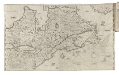
Carte Géographique de la Nouvelle Franse faictte par le Sieur de Champlain Sainttongois Cappitaine Ordinaire pour le Roy en la Marine faict len 1612. Paris, 1612. Belle impression. Cependant une partie importante à gauche de la carte, a été remplacée par un fac-similé (sur environ 11 cm sur toute la longueur) ainsi qu'un rectangle dans le coin inférieur droit (10 x 12 cm). La carte est coupée le long du filet d'encadrement et a été réemmargée. La restauration a été remarquablement effectuée et est très peu visible. Sous passe-partout. - The imprint is very nice: HOWEVER the map has facsimile replacement of missing left part (The left text panel, all the way down) and a rectangle in the lower right corner (half into the ship). The map is trimmed on the neat line and has now extended margins. Restoration is very well done and is hardly notable. 430 x 770 mm. * Cette fameuse carte accompagne "Les Voyages du Sieur de Champlain", ouvrage publié en 1613. C'est une carte majeure car elle est à l'origine de la cartographie des Grands lacs. Les cartes précédentes s'inspirent de celles de Cartier, alors que Champlain, pour réaliser sa carte, s'appuie sur les observations faites lors de ses voyages entre 1603 et 1611. - More than any other map, the 1612 Champlain represents the genesis of Great Lakes cartography. Previous maps of the St. Lawrence valley were extensions of coastal charts and derivatives from Cartier.Here Champlain draws on observations from his voyages between 1603 and 1611 and notes on the North Coast of the Gulf of St. Lawrence, "l'auteur n'a point encorre recongru cette coste"-the author has not yet seen this coast. Such honesty is extraordinary but the recognizableLake Ontario and the conglomerate western lake are compiled from Indian accounts.The map accompanied the 1613 publication of Les Voyages du Sieur de Champlain..., which includes 22 large scale plans for potential harbors. Champlain was devoted to the new land in which he settled and crossed the Atlantic over 20 times to secure claims, promotion, and funding.Champlain incorporated into the map navigational aids intended for sailors with uncorrected French compasses. And in the lower margin his own sketches include strawberries, cherries, raspberries, chestnuts, and hazelnuts which would be found in the northern forests. This map can be reckoned as the first scientific chorography of the region. Champlain hired David Pelletier to draw the Indian figures because he could not draw them well himself. - Heidenreich and Dahl, "The French Mapping of North America in the Seventeenth Century", The Map Collector #13, Dec. 1980; S. E. Morison, Samuel de Champlain: Father of New France. Boston, 1972; Burden, map #160 AMÉRIQUE SEPTENTRIONALE CANADA
Carte Géographique de la Nouvelle Franse faictte par le Sieur de Champlain Sainttongois Cappitaine Ordinaire pour le Roy en la Marine faict len 1612. Paris, 1612. Belle impression. Cependant une partie importante à gauche de la carte, a été remplacée par un fac-similé (sur environ 11 cm sur toute la longueur) ainsi qu'un rectangle dans le coin inférieur droit (10 x 12 cm). La carte est coupée le long du filet d'encadrement et a été réemmargée. La restauration a été remarquablement effectuée et est très peu visible. Sous passe-partout. - The imprint is very nice: HOWEVER the map has facsimile replacement of missing left part (The left text panel, all the way down) and a rectangle in the lower right corner (half into the ship). The map is trimmed on the neat line and has now extended margins. Restoration is very well done and is hardly notable. 430 x 770 mm. * Cette fameuse carte accompagne "Les Voyages du Sieur de Champlain", ouvrage publié en 1613. C'est une carte majeure car elle est à l'origine de la cartographie des Grands lacs. Les cartes précédentes s'inspirent de celles de Cartier, alors que Champlain, pour réaliser sa carte, s'appuie sur les observations faites lors de ses voyages entre 1603 et 1611. - More than any other map, the 1612 Champlain represents the genesis of Great Lakes cartography. Previous maps of the St. Lawrence valley were extensions of coastal charts and derivatives from Cartier.Here Champlain draws on observations from his voyages between 1603 and 1611 and notes on the North Coast of the Gulf of St. Lawrence, "l'auteur n'a point encorre recongru cette coste"-the author has not yet seen this coast. Such honesty is extraordinary but the recognizableLake Ontario and the conglomerate western lake are compiled from Indian accounts.The map accompanied the 1613 publication of Les Voyages du Sieur de Champlain..., which includes 22 large scale plans for potential harbors. Champlain was devoted to the new land in which he settled and crossed the Atlantic over 20 times to secure claims, promotion, and funding.Champlain incorporated into the map navigational aids intended for sailors with uncorrected French compasses. And in the lower margin his own sketches include strawberries, cherries, raspberries, chestnuts, and hazelnuts which would be found in the northern forests. This map can be reckoned as the first scientific chorography of the region. Champlain hired David Pelletier to draw the Indian figures because he could not draw them well himself. - Heidenreich and Dahl, "The French Mapping of North America in the Seventeenth Century", The Map Collector #13, Dec. 1980; S. E. Morison, Samuel de Champlain: Father of New France. Boston, 1972; Burden, map #160 AMÉRIQUE SEPTENTRIONALE CANADA
.jpg)
.jpg)

.jpg)


.jpg)


Testen Sie LotSearch und seine Premium-Features 7 Tage - ohne Kosten!
Lassen Sie sich automatisch über neue Objekte in kommenden Auktionen benachrichtigen.
Suchauftrag anlegen