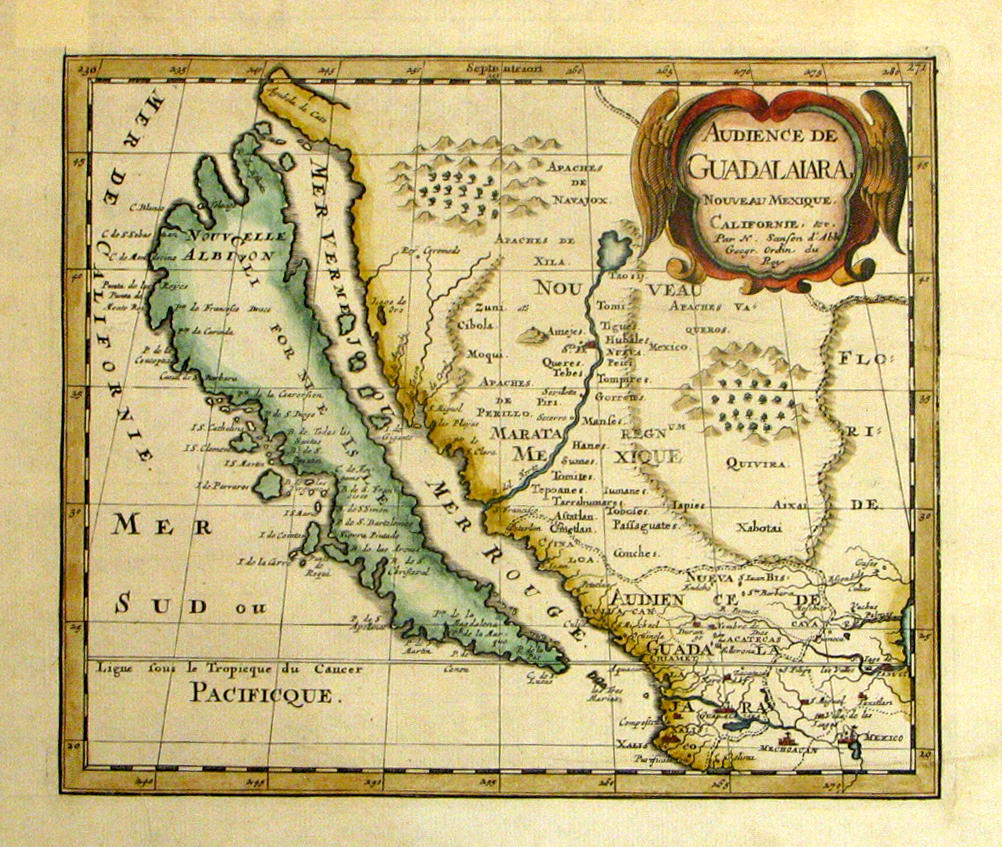
CALIFORNIA AS AN ISLAND.] [JANSSON, Joannes (1588-1664)]. Mar del Zur Hispanis Mare Pacificum. [Amsterdam: c.1650 or later]. Hand-colored engraved map. 440 x 282 mm. The west coast of North and South America, California as an island. Latin text on verso. (A few repairs on verso at edges, upper right corner torn away.) See Tooley 10 (citing a larger issue of "545 x 440 mm").
CALIFORNIA AS AN ISLAND.] [JANSSON, Joannes (1588-1664)]. Mar del Zur Hispanis Mare Pacificum. [Amsterdam: c.1650 or later]. Hand-colored engraved map. 440 x 282 mm. The west coast of North and South America, California as an island. Latin text on verso. (A few repairs on verso at edges, upper right corner torn away.) See Tooley 10 (citing a larger issue of "545 x 440 mm"). BLAEU, Willem and Jan. Nova Hispania et Nova Gallica. [Amsterdam, ca 1650]. Engraved map colored in outline. 388 x 500 mm. KINO, Eusebio and Emanuel BOWEN Passage by Land to California Discover'd by the Rev. Father Eusebius Francis Kino Jesuit; between the Years 1698 & 1701. London, 1708. Engraved map, 200 x 192 mm. the end of California as an island. An early English map accurately depicting the lower California region (showing it as a peninsula rather than an island), and giving correct positions of the Colorado River, the Gila River, the Sonoran desert and much of present-day Arizona. See Wheat, Transmississippi West 89; See Wagner, Northwest Coast 483; See Schwartz & Ehrenberg, plate 75. KINO, Eusebio and Emanuel BOWEN Un Passaggio per Terra a California N.p. n.d. Engraved map 210 x 155 mm. Early Italian version of the above map. ROBERT DE VAUGONDY, Didier. Carte De La Californie Et Des Pays Nord Ouest separes de L'Asie par le Detroit d'Anian 1772. Paris, 1772. Engraved map, 323 x 360 mm. See Wheat 159. BONNE, Rigobert. Le Nouveau Mexique. Paris, 1778. Engraved map, 230 x 350 mm. ROBERT DE VAUGONDY, Didier. Carte De La Californie Suivant I La Carte manuscrite de l'Amérique de Mathieu Néeron Pecci olen dressee a Florence en 1604, II Sanson 1656 ... Paris, 1772. Engraved map, 315 x 400 mm. This map appeared in the Supplement to Diderot's encyclopedia. (7)


Testen Sie LotSearch und seine Premium-Features 7 Tage - ohne Kosten!
Lassen Sie sich automatisch über neue Objekte in kommenden Auktionen benachrichtigen.
Suchauftrag anlegen