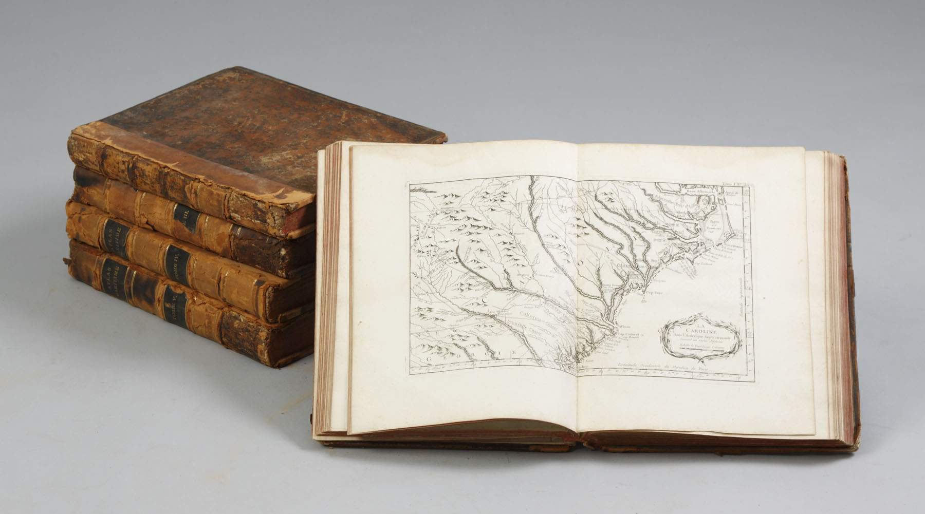
BELLIN, Jacques Nicolas Le Petit Atlas maritime recueil de cartes et plans des quatre parties du Monde. Paris: Bellin, 1764.
BELLIN, Jacques Nicolas Le Petit Atlas maritime recueil de cartes et plans des quatre parties du Monde. Paris: Bellin, 1764. 6 parts in 5 volumes (volume 3 in 2 parts), 4° (314 x 238 mm). Engraved general title, 6 engraved divisional titles, engraved dedication and indexes and 577 engraved maps, charts and plans by Croisey, many double-page or folding, mostly with CONTEMPORARY HAND COLORING. (Some occassional minor staining.) Contemporary red morocco gilt, central coat-of-arms of Charles de Rohan, Prince de Soubise, within border of triple fillet, floral corner ornaments, spine in six compartments, gilt lettered in two, others elaborately tooled in gilt, gilt edges (a few spine ends restored). Provenance: Charles de Rohan, Prince de Soubise (1715-1787), the favorite of Louis XV and Mme de Pompadour, who made up for being one of the worst field commanders in French history by being one of the best French book collectors of his time. His defeat at Rossbach by Frederick the Great in 1757 became legend, still commented upon by Napoleon half a century later. He was fortunate in being the nephew and heir of a passionate book collector, Cardinal Armand de Rohan-Soubise (1674-1749), whose library included the Bibliotheca Thuana which the Cardinal had acquired from Charron de Menars (coat-of arms on binding, see Olivier, I. 2034). FIRST EDITION, OF ONE OF THE MOST IMPORTANT MARITIME ATLASES PUBLISHED IN THE 18TH-CENTURY. Jacques Nicolas Bellin held officIal status as royal hydrographer and ingéniuer géographe de la marine et du Dépot des Cartes et Plans. He was responsible for compiling atlases of sailing charts for military and offical use as well as for commercial publication. The first volume includes plans of Quebec, Boston, New York, Philadelphia, New Orleans and plans of other British colonial towns. The maritime atlas includes "a large amount of fresh material" (NMM). The contents of the five volumes is arranged geographically: Volume I: L'Amérique Septentrionale et les Isles Antilles (102 plates) Volume II: L'Amérique Méridionale (89 plates) Volume III part I: L'Asie (69 plates) Volume III part II: L'Afrique (70-124 plates) and plates 92 bis Isle de Mogador and 95 bis Costes du Senegal Volume IV: L'Europe (128 plates) Volume V: Les costes de France (132 plates). NMM 211 (listing 580 maps); Nordenskiöld 10; Phillips Atlases 638; Sabin 4555. See lot 75.


.jpg)


.jpg?w=400)


Testen Sie LotSearch und seine Premium-Features 7 Tage - ohne Kosten!
Lassen Sie sich automatisch über neue Objekte in kommenden Auktionen benachrichtigen.
Suchauftrag anlegen